Near Bolivar in Jefferson County, West Virginia — The American South (Appalachia)
Holy Ground
Harpers Ferry National Historical Park
— National Park Service, U.S. Department of the Interior —
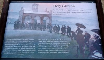
Here on the scene of John Brown’s martyrdom we reconsecrate ourselves, our honor, our property to the final emancipation of the race which John Brown died to make free… Thank God for John Brown!... and all the hallowed dead who died for freedom!
W.E.B. Du Bois, Niagara Movement general secretary and NAACP founding member
On August 17, 1906, members of the Niagara Movement walked silently past where you are standing. One of the first modern civil rights organizations in America, the Niagara Movement fought for racial equality and political representation at all social levels. Its members’ efforts laid the foundation for creating the National Association for the Advancement of Colored People (NAACP) in 1909. Niagara participants came here to the site of John Brown’s Fort to honor Brown, who died to end slavery.
Black scholar Dr. Benjamin Quarles described their arrival: “As they neared their destination they formed a procession, single file, led by Owen M. Waller, a physician from Brooklyn. Defying stone and stubble, Waller took off his shoes and socks and walked barefoot as if treading on holy ground.” Other members followed suit and together they walked barefoot to the fort. As they circled the fort they sang verses of John Brown’s Body and The Battle Hymn of the Republic.
Erected by National Park Service, U.S. Department of the Interior.
Topics. This historical marker is listed in these topic lists: African Americans • Civil Rights. A significant historical year for this entry is 1906.
Location. 39° 18.483′ N, 77° 45.703′ W. Marker is near Bolivar, West Virginia, in Jefferson County. Marker can be reached from Murphy Road, on the right when traveling south. Located on the Murphy Farm trail in the Harpers Ferry National Historical Park. The Trail can be reached from the park's visitor center, located on Shoreline Drive south of Highway 340. Touch for map. Marker is in this post office area: Harpers Ferry WV 25425, United States of America. Touch for directions.
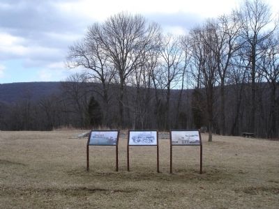
Other nearby markers. At least 8 other markers are within walking distance of this marker. Pilgrimage (here, next to this marker); A Moving Symbol (here, next to this marker); The Murphy Farm (within shouting distance of this marker); Mountains, Men, and Maneuvers (about 400 feet away, measured in a direct line); Sheridan Dug In (about 800 feet away); The Fate of Harpers Ferry was sealed. (approx. 0.2 miles away); Struggle to the Heights (approx. ¼ mile away); From Civil War to Civil Rights / Battle of Harpers Ferry (approx. 0.3 miles away). Touch for a list and map of all markers in Bolivar.
More about this marker. The background of the marker is a depiction of the scene described by Dr. Quarles in the text.
Also see . . .
1. The Niagra Movement - The Cornerstone of the Modern Civil Rights Era. Harpers Ferry National Historical Park website entry (Submitted on June 15, 2008, by Craig Swain of Leesburg, Virginia.)
2. W.E.B. DuBois. National Park Service page providing a short biography of DuBois. (Submitted on June 15, 2008, by Craig Swain of Leesburg, Virginia.)
Credits. This page was last revised on February 2, 2022. It was originally submitted on June 13, 2008. This page has been viewed 1,518 times since then and 21 times this year. Photos: 1, 2. submitted on June 13, 2008. 3. submitted on November 3, 2008, by Craig Swain of Leesburg, Virginia. • Craig Swain was the editor who published this page.


