
Near Lebanon in Wilson County, Tennessee — The American South (East South Central)
James Chamberlain Jones
<------<<<<
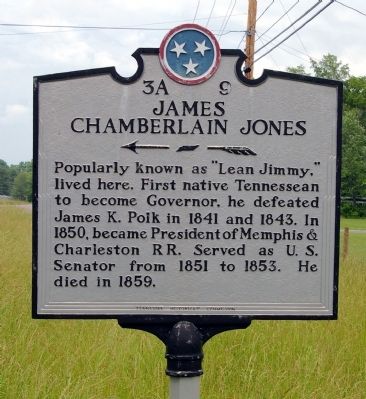
Photographed by David Seibert, May 25, 2009
1. James Chamberlain Jones Marker
Erected by Tennessee Historical Commission. (Marker Number 3A 9.)
Topics and series. This historical marker is listed in these topic lists: Government & Politics • Industry & Commerce • Railroads & Streetcars. In addition, it is included in the Tennessee Historical Commission series list. A significant historical year for this entry is 1841.
Location. 36° 14.389′ N, 86° 17.356′ W. Marker is near Lebanon, Tennessee, in Wilson County. It is on Hunters Point Pike (U.S. 231) 0.2 miles south of Rutledge Lane, on the right when traveling north. Touch for map. Marker is in this post office area: Lebanon TN 37087, United States of America. Touch for directions.

Regionally, this marker is in Middle Tennessee and in Greater Nashville. It is also in the American South and specifically in the Upper South. Globally, it is in North America, the Western Hemisphere, the Western
this page online
Other nearby markers. At least 8 other markers are within 3 miles of this marker, measured as the crow flies: Camp Bell (approx. 1½ miles away); Seawell Hill Camp (approx. 2.1 miles away); Lest We Forget / One Nation Under God (approx. 2.1 miles away); Castle Heights Military Academy Supreme Sacrifice Monument (approx. 2.1 miles away); Pickett Chapel Methodist Church (approx. 2.1 miles away); Pickett Chapel / Civil Rights (approx. 2.1 miles away); History of the Logs Used in this Cabin (approx. 2.2 miles away); Neddy Jacobs Cabin (approx. 2.2 miles away). Touch for a list and map of all markers in Lebanon.
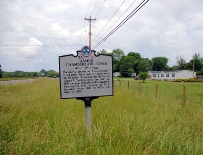
Photographed by David Seibert, May 25, 2009
2. James Chamberlain Jones Marker
Looking north on US 231.
Credits. This page was last revised on January 12, 2025. It was originally submitted on May 27, 2009, by David Seibert of Sandy Springs, Georgia. This page has been viewed 2,506 times since then and 58 times this year. Last updated on May 12, 2015, by J. Makali Bruton of Washington, District of Columbia. Photos: 1, 2. submitted on May 27, 2009, by David Seibert of Sandy Springs, Georgia. • Bill Pfingsten was the editor who published this page.
