Goodlettsville in Davidson County, Tennessee — The American South (East South Central)
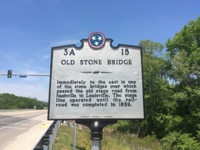
Old Stone Bridge
Immediately to the east is one of the stone bridges over which passed the old stage road from Nashville to Louisville. The stage line operated until the rail-road was completed in 1859.
Erected by the Tennessee Historical Commission. (Marker Number 3A 15.)
Topics and series. This historical marker is listed in these topic lists: Bridges & Viaducts • Waterways & Vessels. In addition, it is included in the Tennessee Historical Commission series list. A significant historical year for this entry is 1859.
Location. 36° 20.289′ N, 86° 43.044′ W. Marker is in Goodlettsville, Tennessee, in Davidson County. Marker is at the intersection of North Main Street (U.S. 41) and Old Springfield Pike, on the right when traveling north on North Main Street. North Main Street is also known as Dickerson Pike. Touch for map. Marker is at or near this postal address: North Main Street, Goodlettsville TN 37072, United States of America. Touch for directions.
Other nearby markers. At least 8 other markers are within 2 miles of this marker, measured as the crow flies. Alexander Wilson (approx. 0.4 miles away); Mansker’s Station (approx. 1.2 miles away); In Memory of Casper Mansker (approx. 1.2 miles away); Mansker's Forts and Walton's Campground (approx. 1.2 miles away); Casper Mansker (approx. 1.2 miles away); Mansker’s First Fort (approx. 1.3 miles away); William Bowen House (approx. 1.3 miles away); Goodlettsville Cumberland Presbyterian Church (approx. 1.4 miles away). Touch for a list and map of all markers in Goodlettsville.
Also see . . . Facts about Stone Bridge. Bridgehunter website entry (Submitted on May 14, 2015, by Mark Hilton of Montgomery, Alabama.)
Credits. This page was last revised on May 29, 2023. It was originally submitted on May 14, 2015, by Mark Hilton of Montgomery, Alabama. This page has been viewed 751 times since then and 60 times this year. Last updated on May 15, 2015, by J. Makali Bruton of Accra, Ghana. Photos: 1, 2, 3, 4. submitted on May 14, 2015, by Mark Hilton of Montgomery, Alabama.


