Port Bolivar in Galveston County, Texas — The American South (West South Central)
Bolivar Point
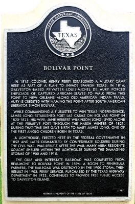
While commanding a filibuster to win Texas independence, James Long established Fort Las Casas on Bolivar Point in 1820-21. His wife, Jane Herbert (Wilkinson), gave birth to a daughter, Mary James, in December 1821 at the fort. Mary James Long is often referred to as the first Anglo child born in Texas.
A lighthouse, erected here by the Federal government in 1852 and later dismantled by Confederate soldiers during the Civil War, was rebuilt after the war. Many area residents sought shelter within the lighthouse during the damaging storms of 1900 and 1915.
The Gulf and Interstate Railroad was completed from Beaumont to Bolivar Point in 1896. A boon to peninsula farmers, the railroad was destroyed in the 1900 storm, then rebuilt in 1903. Ferry service, purchased by the Texas Highway Department in 1933, continues to provide free public access to Galveston Island.
Erected 1995 by Texas Historical Commission. (Marker Number 181.)
Topics. This historical marker is listed in these topic lists: African Americans • Disasters • Settlements & Settlers • War, US Civil. A significant historical month for this entry is December 1821.
Location. 29° 22.083′ N, 94° 45.499′ W. Marker is in Port Bolivar, Texas, in Galveston County. Marker is at the intersection of State Highway 87 and Anderson Avenue, on the right when traveling east on State Highway 87. Marker is located at the entrance to Fort Travis Seashore Park. Touch for map. Marker is in this post office area: Port Bolivar TX 77650, United States of America. Touch for directions.
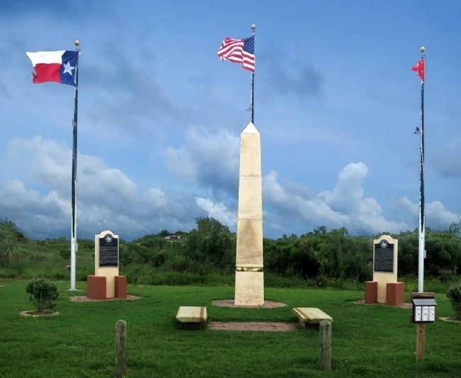
Other nearby markers. At least 8 other markers are within 3 miles of this marker, measured as the crow flies. Jane Herbert Wilkinson Long (a few steps from this marker); Fort Travis (approx. 0.2 miles away); Fort San Jacinto (approx. 2.3 miles away); SS Selma (approx. 2˝ miles away); Galveston: Gateway to Texas (approx. 2˝ miles away); Galveston Quarantine Stations (approx. 2˝ miles away); U.S.S. Seawolf Memorial (approx. 2.7 miles away); Galveston Island (approx. 2.9 miles away). Touch for a list and map of all markers in Port Bolivar.
Also see . . . Bolivar Point in The Handbook of Texas. (Submitted on May 17, 2015, by Jim Evans of Houston, Texas.)

Photographed By Jim Evans
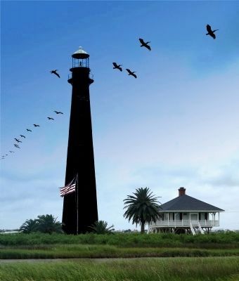
4. Lighthouse Across the Highway From Markers
Point Bolivar Light is a historic lighthouse in Port Bolivar, Texas, that was built in 1872. It served for 61 years before being retired in 1933.
The current lighthouse is at least the second structure at the site. The first lighthouse was built in the mid-1850s and was taken down during the Civil War so that Union warships could not use it as a navigational aid.
After withstanding over 150 years of erosion, the lighthouse is now entirely black. This has caused some to call it "The Haunted Lighthouse" of Bolivar.
Credits. This page was last revised on June 16, 2016. It was originally submitted on May 17, 2015, by Jim Evans of Houston, Texas. This page has been viewed 804 times since then and 45 times this year. Photos: 1, 2, 3. submitted on May 17, 2015, by Jim Evans of Houston, Texas. 4. submitted on May 16, 2015, by Jim Evans of Houston, Texas. • Bernard Fisher was the editor who published this page.


