Cahaba in Dallas County, Alabama — The American South (East South Central)
Kirk-View Farm
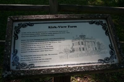
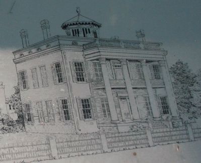
Despite this trend, returning Confederate veteran Samuel McCurdy Kirkpatrick and his wife Sarah purchased a large brick house and outlying structures here on the northern edge of town. They acquired many of the vacated town lots and consolidated them into a large farm. For nearly seventy years, three generations of Kirkpatricks managed a model farm here called "Kirk-View."
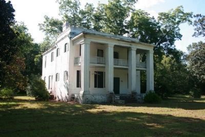
The Kirkpatrick home burned in 1935. The structure you see today was one of two located behind the house and was originally constructed as slave quarters.
Erected by Alabama Historical Commission.
Topics and series. This historical marker is listed in these topic lists: African Americans • Settlements & Settlers • War, US Civil. In addition, it is included in the Alabama Historical Commission series list. A significant historical year for this entry is 1866.
Location. Marker has been permanently removed. It was located near 32° 19.434′ N, 87° 5.892′ W. Marker was in Cahaba, Alabama, in Dallas County. Marker was on Oak Street (County Road 155), on the left when traveling north. Touch for map. Marker was in this post office area: Orrville AL 36767, United States of America.
We have been informed that this sign or monument is no longer there and will not be replaced. This page is an archival view of what was.
Other nearby markers. At least 8 other markers are within walking distance of this location. The Duke of Cahaba (within shouting distance of this marker); Behind the Big House (within shouting distance of this marker); Who Lived Here? (approx. 0.3 miles away); Death in the Street (approx. 0.3 miles away); The Hole That Was Once a Row (approx. 0.4 miles away); General Lafayette Visits Cahawba (approx. 0.4 miles away); Drug Store & the Rooms Above (approx. 0.4 miles away); Yankees in Cahawba (approx. 0.4 miles away). Touch for a list and map of all markers in Cahaba.
More about this marker. Located in the Old Cahawba Archaelogical Park.
Also see . . .
1. Old Cahawba, "Alabama's most famous Ghost Town". (Submitted on September 10, 2009, by Timothy Carr of Birmingham, Alabama.)
2. Black and white photo of the Kirk-View farm main house. (Submitted on September 10, 2009, by Timothy Carr of Birmingham, Alabama.)
Credits. This page was last revised on January 10, 2018. It was originally submitted on September 10, 2009, by Timothy Carr of Birmingham, Alabama. This page has been viewed 2,577 times since then and 34 times this year. Last updated on May 20, 2015, by J. Makali Bruton of Accra, Ghana. Photos: 1, 2, 3. submitted on September 10, 2009, by Timothy Carr of Birmingham, Alabama. • Bernard Fisher was the editor who published this page.


