Islamorada in Monroe County, Florida — The American South (South Atlantic)
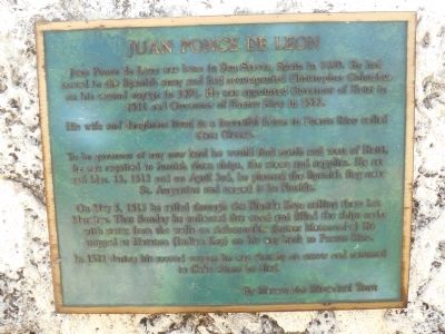
Juan Ponce de Leon
His wife and daughter lived in a beautiful home in Puerto Rico called Casa Blanca.
To be governor of any new land he would find north and west of Haiti, he was required to furnish three ships, the crews, and supplies. He set out March 13, 1513 and on April 3, he planted the Spanish flag near St. Augustine and named it La Florida.
On May 5, 1513, he sailed through the Florida Keys, calling them Los Martires. That Sunday, he collected firewood and filled the ships's casks with water from the wells on Achecombie (Lower Matecumbe). He stopped in Matanca (Indian Key)on his way back to Puerto Rico.
In 1521, during his second voyage, he was shot by an arrow and returned to Cuba where he died.
Erected by Matecumbe Historical Trust.
Topics. This historical marker is listed in this topic list: Exploration. A significant historical month for this entry is March 1859.
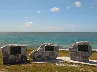
Location. 24° 53.365′ N, 80° 40.568′ W. Marker is in Islamorada, Florida, in Monroe County. Marker is on Overseas Highway (U.S. 1 at milepost 78), 1.9 miles south of State Road 4a, on the left when traveling south. The marker is one of a group of three markers on boulders on the ocean side of Overseas Highway. Touch for map. Marker is in this post office area: Islamorada FL 33036, United States of America. Touch for directions.
Other nearby markers. At least 8 other markers are within walking distance of this marker. Rafters (here, next to this marker); Spanish Treasure Fleet of 1733 (here, next to this marker); Florida East Coast Railroad Oversea Extension (within shouting distance of this marker); Triangle of History (about 300 feet away, measured in a direct line); Indian Key Historic State Park (about 300 feet away); San Pedro Underwater Archaeological Preserve (about 400 feet away); Tea Table Key (about 500 feet away); Indian Key (approx. 0.3 miles away). Touch for a list and map of all markers in Islamorada.
Credits. This page was last revised on January 25, 2018. It was originally submitted on May 21, 2015, by Marsha A. Matson of Palmetto Bay, Florida. This page has been viewed 626 times since then and 20 times this year. Photos: 1, 2. submitted on May 21, 2015, by Marsha A. Matson of Palmetto Bay, Florida. • Bernard Fisher was the editor who published this page.

