Greater Napanee in Lennox and Addington County, Ontario — Central Canada (North America)
Bay of Quinte Loyalist Settlement
L’Etablissement des Loyalistes dans la Baie d Quinte
Photographed by Barry Swackhamer, August 8, 2014
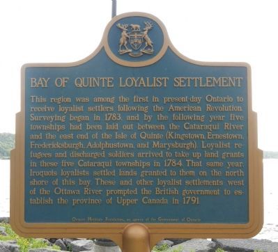
1. Bay of Quinte Loyalist Settlement Marker
This region was among the first in present day Ontario to receive loyalist settlers following the American Revolution. Surveying began in 1783, and by the following year five townships had been laid out between the Cataraqui River and the east end of the Isle of Quinte (Kingstown, Ernestown, Fredericksburgh, Adolphustown, and Marysburgh). Loyalist refugees and discharged soldiers arrived to take up land grants in these five Cataraqui townships in 1784. That same year, Iroquois loyalists settled lands granted to them on the north shore of this bay. These and other loyalist settlements west of the Ottawa River prompted the British government to establish the province of Upper Canada in 1791.
French:
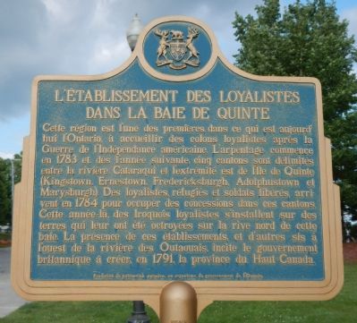
Cette région est l’une des premières, dans ce qui est aujourd’hui l’Ontario, à accueillir des colons loyalistes après la Guerre de l’Indépendance américaine. L’arpentage commence en 1783 et, dès l’année suivante, cinq cantons sont délimites entre la rivière Cataraqui et l’extrémité est de l’Île de Quinte (Kingstown, Ernestown, Fredericksburg, Adolphustown et Marysburgh). Des loyalistes, réfugiés et soldats libérés,
this page online
Erected by Ontario Heritage Foundation, an agency of the Government of Ontario.
Topics and series. This historical marker is listed in these topic lists: Fraternal or Sororal Organizations • Settlements & Settlers. In addition, it is included in the Canada, Ontario Heritage Trust series list. A significant historical year for this entry is 1783.
Location. 44° 2.873′ N, 77° 3.059′ W. Marker is in Greater Napanee, Ontario, in Lennox and Addington County. It is on Loyalist Parkway (Provincial Highway 33) close to Quinte View Road, on the right when traveling west. Touch for map. Marker is at or near this postal address: 11042 Loyalist Parkway, Greater Napanee ON K0K, Canada. Touch for directions.

Regionally, this marker is in Eastern Ontario and specifically in Southeastern
Photographed by Barry Swackhamer, August 8, 2014
2. L’Etablissement des Loyalistes dans la Baie d Quinte Marker
Other nearby markers. At least 8 other markers are within 8 kilometers of this marker, measured as the crow flies: The Royal Union Flag (a few steps from this marker); a different marker also named The Royal Union Flag (approx. one kilometer away); The Quakers of Adolphustown (approx. 5.8 kilometers away); Old Hay Bay Church / La vielle église de la Baie Hay (approx. 6.5 kilometers away); Hay Bay Church (approx. 6.5 kilometers away); The White Chapel (approx. 7.2 kilometers away); The Rev. William Macauley (approx. 7.9 kilometers away); Macaulay Heritage Park (approx. 8 kilometers away). Touch for a list and map of all markers in Greater Napanee.
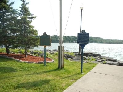
More about this marker. This marker is located in a small park next to the eastern terminal of the Glenora Ferry.
Also see . . . United Empire Loyalists - Wikipedia.
Photographed by Barry Swackhamer, August 8, 2014
3. Bay of Quinte Loyalist Settlement Marker
The marker is on the left.
Credits. This page was last revised on September 27, 2019. It was originally submitted on May 24, 2015, by Barry Swackhamer of Brentwood, California. This page has been viewed 1,132 times since then and 64 times this year. Photos: 1, 2, 3. submitted on May 24, 2015, by Barry Swackhamer of Brentwood, California. • Andrew Ruppenstein was the editor who published this page.
