Gadsden in Etowah County, Alabama — The American South (East South Central)
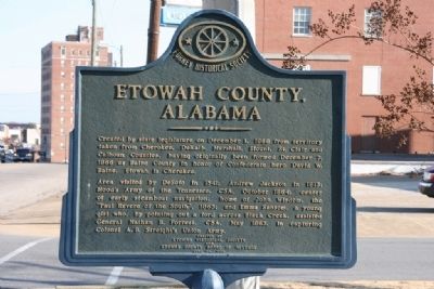
Etowah County, Alabama
Area visited by DeSoto in 1541; Andrew Jackson in 1813; Hood’s Army of the Tennessee, CSA, October 1864; center of early steamboat navigation; home of John Wisdom, the “Paul Revere of the South,” 1863; and Emma Sansom, a young girl who, by pointing out a ford across Black Creek, assisted General Nathan B. Forrest, CSA, May 1863, in capturing Colonel A. B. Streight’s Union Army.
Erected by Etowah Historical Society and Etowah County Board of Revenue June 26, 1968.
Erected 1968 by Foney Historical Society.
Topics and series. This historical marker is listed in these topic lists: Government & Politics • Notable Places. In addition, it is included in the Former U.S. Presidents: #07 Andrew Jackson series list. A significant historical month for this entry is May 1863.
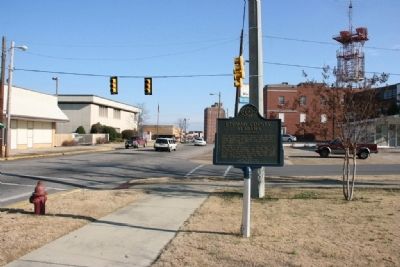
Location. 34° 0.93′ N, 86° 0.7′ W. Marker is in Gadsden, Alabama, in Etowah County. Marker is at the intersection of Forrest Avenue and South 8th Street, on the right when traveling east on Forrest Avenue. Touch for map. Marker is in this post office area: Gadsden AL 35901, United States of America. Touch for directions.
Other nearby markers. At least 8 other markers are within walking distance of this marker. Congregation Beth Israel (about 500 feet away, measured in a direct line); William Luther Sibert Major General U.S. Army (Ret.) (approx. 0.2 miles away); Colonel Hood House (approx. 0.2 miles away); Gunn-Bellenger House (approx. 0.2 miles away); Eleventh Street School (approx. 0.4 miles away); The North Alabama Conference of the United Methodist Church (approx. 0.4 miles away); Gadsden Times-News Building (approx. 0.4 miles away); Gadsden, Alabama (approx. ¾ mile away). Touch for a list and map of all markers in Gadsden.
Credits. This page was last revised on May 9, 2021. It was originally submitted on December 19, 2010, by Timothy Carr of Birmingham, Alabama. This page has been viewed 1,421 times since then and 26 times this year. Last updated on May 26, 2015, by J. Makali Bruton of Accra, Ghana. Photos: 1, 2, 3, 4. submitted on December 19, 2010, by Timothy Carr of Birmingham, Alabama. • Bernard Fisher was the editor who published this page.


