Marker Logo HMdb.org THE HISTORICAL
MARKER DATABASE
“Bite-Size Bits of Local, National, and Global History”
Annesdale Park in Memphis in Shelby County, Tennessee — The American South (East South Central)
 

Annesdale Park Subdivision


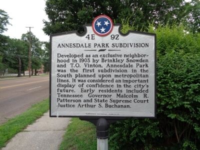
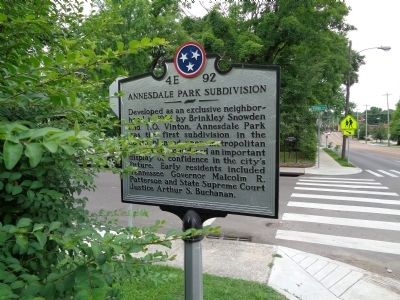
Annesdale Park Subdivision Marker image. Click for full size.
Photographed By Steve Masler, May 27, 2015
1. Annesdale Park Subdivision Marker
Inscription. Developed as an exclusive neighborhood in 1903 by Brinkley Snowden and T. O. Vinton, Annesdale Park was the first subdivision in the South planned upon metropolitan lines. It was considered an important display of confidence in the city's future. Early residents included Tennessee Governor Malcolm R. Patterson and State Supreme Court Justice Arthur S. Buchanan.
 
Erected by Tennessee Historical Commission. (Marker Number 4E 92.)
 
Topics and series. This historical marker is listed in this topic list: Political Subdivisions. In addition, it is included in the Tennessee Historical Commission series list. A significant historical year for this entry is 1903.
 
Location. 35° 7.849′ N, 90° 1.25′ W. Marker is in Memphis, Tennessee, in Shelby County. It is in Annesdale Park. Marker is at the intersection of Vinton and Bellevue (U.S. 51), on the right when traveling west on Vinton. Touch for map. Marker is at or near this postal address: 1212-1234 Vinton Ave, Memphis TN 38104, United States of America. Touch for directions.
 
Other nearby markers. At least 8 other markers are within walking distance of this marker. The Memphis 13/Bruce Elementary (about 500 feet away, measured in a direct line); St. John's United Methodist Church (about 700 feet away); Pigeon Roost Road (approx. ¼ mile away); Kuni Wada Bakery Remembrance (approx.
Paid Advertisement
Click on the ad for more information.
Please report objectionable advertising to the Editor.
Click or scan to see
this page online
0.6 miles away); Confederate Soldiers Rest (approx. 0.6 miles away); Captain Kit Dalton (approx. 0.6 miles away); Metropolitan Inter~Faith Association (approx. 0.6 miles away); No Man's Land Memorial (approx. 0.6 miles away). Touch for a list and map of all markers in Memphis.
 
Annesdale Park Subdivision Marker image. Click for full size.
Photographed By Steve Masler, May 27, 2015
2. Annesdale Park Subdivision Marker
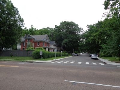
View of Annesdale Park down Vinton with marker on left image. Click for full size.
Photographed By Steve Masler, May 27, 2015
3. View of Annesdale Park down Vinton with marker on left
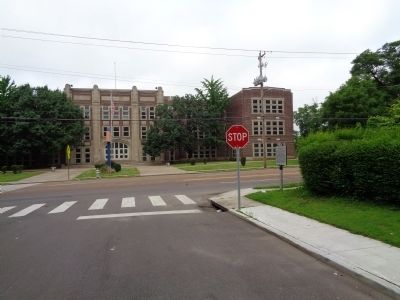
View to Belleview (U.S. 51) looking west to Bellview Middle School. Marker on right image. Click for full size.
Photographed By Steve Masler, May 27, 2015
4. View to Belleview (U.S. 51) looking west to Bellview Middle School. Marker on right
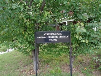
View of Annesdale Park Neighborhood Marker image. Click for full size.
Photographed By Steve Masler, May 27, 2015
5. View of Annesdale Park Neighborhood Marker
 
 
Credits. This page was last revised on February 7, 2023. It was originally submitted on May 28, 2015, by Steve Masler of Memphis, Tennessee. This page has been viewed 516 times since then and 27 times this year. Photos:   1, 2, 3, 4, 5. submitted on May 28, 2015, by Steve Masler of Memphis, Tennessee. • Bill Pfingsten was the editor who published this page.
Share this page.  
Share on Tumblr
m=83793

CeraNet Cloud Computing sponsors the Historical Marker Database.
This website earns income from purchases you make after using our links to Amazon.com. We appreciate your support.
Paid Advertisement
Apr. 24, 2024