Near Charleston in Charleston County, South Carolina — The American South (South Atlantic)
Morris Island
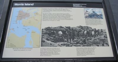
Confederate batteries hidden in the dunes of Morris Island, directly in front of you, commanded the approach to Charleston Harbor. Union forces needed Morris Island, a key location from which to attack Fort Sumter, less than one mile away.
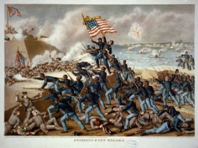
On July 18, 1863, a direct assault failed against Fort Wagner, a Confederate stronghold near Morris Island's north end. The Union then changed tactics, subjecting Fort Wagner to a two-month siege. The Confederates finally evacuated, abandoning Morris Island on September 6, 1863. Union gunners then aimed powerful rifled cannon at Fort Sumter. In the next two years, massive bombardments reduced most of Sumter to rubble.
Erected by Fort Sumter National Monument, South Carolina - National Park Service - U.S. Department of the Interior.
Topics. This historical marker is listed in this topic list: War, US Civil. A significant historical date for this entry is July 18, 1863.
Location. 32° 45.134′ N, 79° 52.476′ W. Marker is near Charleston, South Carolina, in Charleston County. Marker is located at Fort Sumter National Monument and only reached by boat. See links below for more information about access to the site. Touch for map. Marker is in this post office area: Charleston SC 29412, United States of America. Touch for directions.
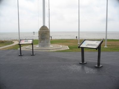
Other nearby markers. At least 8 other markers are within walking distance of this marker. A different marker also named Morris Island (here, next to this marker); Flags of the Fort (a few steps from this marker); Major Robert Anderson (a few steps from this marker); Fort Johnson (a few steps from this marker); Fort Moultrie (a few steps from this marker); Charleston Besieged (a few steps from this marker); 8-inch (200 Pounder) Parrott (a few steps from this marker); Battery Huger (within shouting distance of this marker). Touch for a list and map of all markers in Charleston.
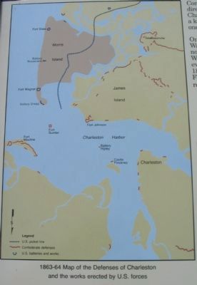
More about this marker. On the left is a 1863-64 Map of the Defenses of Charleston and the works erected by U.S. forces. In 1863-64 Confederates still held most of the strategic positions around Charleston Harbor. The Union Navy failed to take Fort Sumter by sea, and in June 1862 the Army failed against Secessionville, south of Charleston. Controlling Morris Island in 1863 enabled the Union to bombard Fort Sumter and Charleston.
In the lower center is a wartime photo showing Union soldiers at Battery Rosecrans, Morris Island, fire 100-pounder Parrott rifles at Fort Sumter, about two miles away. The Union bombardment
continued for 22 months, one of the longest sieges in U.S. military history. Fort Sumter was decimated, but its Confederate garrison refused to surrender.
In the upper right is an illustration depicting the Assault on Fort Wagner, July 18, 1863. The 54th Massachusetts Infantry, a black regiment, led the direct assault. Under intense fire, the 54th briefly gained Wagner's parapet, but fell back with heavy loss. Though the assault failed, it proved the courage of black troops and confirmed their military value for the Union.
Also see . . .
1. Second Battle of Fort Wagner. Wikipedia article. (Submitted on May 17, 2010, by Craig Swain of Leesburg, Virginia.)
2. Battery Wagner. American Battlefield trust website entry:
The site of the battery, while reduced somewhat due to shore erosion, is the focus of a preservation effort. (Submitted on May 17, 2010, by Craig Swain of Leesburg, Virginia.)
Additional keywords. Fort Wagner; Battery Wagner; 54th Massachusetts Volunteer Infantry; Glory; William H. Carney; Quincy Gillmore; Robert Gould Shaw; Immortal Six Hundred; USCT; U.S. Colored Troops.
Photographed By Craig Swain, May 3, 2010
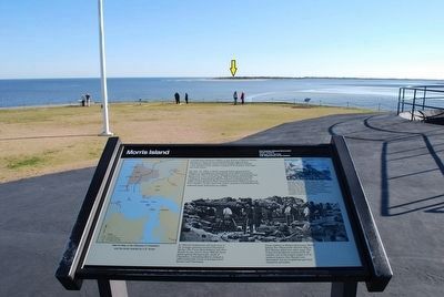
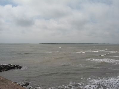
4. Morris Island From Fort Sumter
Looking south toward Morris Island. The island has eroded inland since the Civil War, and the site of the Confederate defense works is now mostly under water. The lighthouse which stood at the other end of Morris Island is now completely surrounded by water.
Credits. This page was last revised on April 17, 2021. It was originally submitted on May 17, 2010, by Craig Swain of Leesburg, Virginia. This page has been viewed 1,642 times since then and 68 times this year. Last updated on June 2, 2015, by J. Makali Bruton of Accra, Ghana. Photos: 1, 2, 3, 4. submitted on May 17, 2010, by Craig Swain of Leesburg, Virginia. 5. submitted on August 10, 2015, by Brandon Fletcher of Chattanooga, Tennessee. 6. submitted on May 30, 2009, by Richard E. Miller of Oxon Hill, Maryland. • Bill Pfingsten was the editor who published this page.
