Low Moor in Alleghany County, Virginia — The American South (Mid-Atlantic)
Low Moor Iron Company Coke Ovens
Photographed by J. J. Prats, May 29, 2015
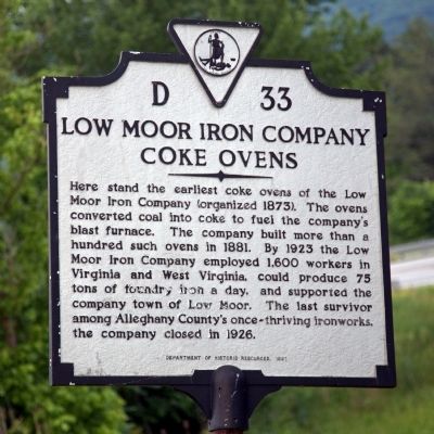
1. Low Moor Iron Company Coke Ovens Marker
Here stand the earliest coke ovens of the Low Moor Iron Company (organized 1873). The ovens converted coal to coke to fuel the company’s blast furnace. The company built more than a hundred such ovens in 1881. By 1923 the Low Moor Iron Company employed 1,600 workers in Virginia and West Virginia, could produce 75 tons of foundry iron a day, and supported the company town of Low Moor. The last survivor among Alleghany County’s once-thriving ironworks, the company closed in 1926.
Erected 1991 by Department of Historic Resources. (Marker Number D-33.)
Topics and series. This historical marker is listed in this topic list: Industry & Commerce. In addition, it is included in the Virginia Department of Historic Resources (DHR) series list. A significant historical year for this entry is 1881.
Location. 37° 47.618′ N, 79° 53.071′ W. Marker is in Low Moor, Virginia, in Alleghany County. It is on Winterbury Avenue NE (Road F-205) north of Exit 21 (Interstate 64), on the right when traveling east. It is on the frontage road to I-64. Take Exit 21 north, away from Low Moor, then turn right. Touch for map. Marker is in this post
this page online

Regionally, this marker is in Virginia’s Mountain Region, in the Alleghany Highlands, and specifically in the Potomac Highlands. It is also in the American South, specifically in the Upper South, in Appalachia, and specifically in Southern Appalachia. Globally, it is in North America, the Western Hemisphere, the Western World, and the Anglosphere. Historically, it finds itself in what was once the territory of the Mississippian Culture, one of the original Thirteen Colonies, one of the Confederate States of America, and the Antebellum South.
Other nearby markers. At least 8 other markers are within 4 miles of this marker, measured as the crow flies: Oakland Grove Presbyterian Church (approx. 1½ miles away); a different marker also named Oakland Presbyterian Church and Cemetery (approx. 1½ miles away); Jackson River Depot (approx. 1½ miles away); C&O Railroad Shops (approx. 2.8 miles away); Chesapeake and Ohio Lines (approx. 3.4 miles away); Masonic Theatre (approx. 3.6 miles away); World War I Memorial (approx. 3.6 miles away); World War Memorial
Photographed by J. J. Prats, May 29, 2015
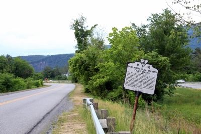
2. Low Moor Iron Company Coke Ovens Marker
Low Moor Iron Company - Historical Sketches
The Humphries Family website entry
Click for more information.
The Humphries Family website entry
Click for more information.
Other markers no longer nearby. Oakland Presbyterian Church and Cemetery (was approx. 1.4 miles away but has been permanently removed); Oakland Presbyterian Church (was approx. 1½ miles away but has been permanently removed).
Credits. This page was last revised on April 24, 2022. It was originally submitted on June 3, 2015, by J. J. Prats of Powell, Ohio. This page has been viewed 1,519 times since then and 56 times this year. Photos: 1, 2. submitted on June 3, 2015, by J. J. Prats of Powell, Ohio.
Editor’s want-list for this marker. Photos of the coke ovens • Can you help?
