Knights Landing in Yolo County, California — The American West (Pacific Coastal)
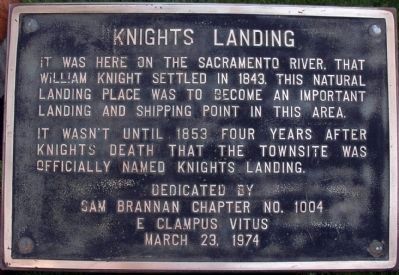
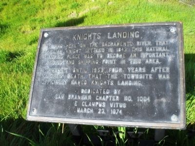
Knights Landing
It wasn't until 1853 four years after Knights death that the townsite was officially named Knights Landing.
Erected 1974 by Sam Brannan Chapter No. 1004, E Clampus Vits.
Topics and series. This historical marker is listed in this topic list: Notable Places. In addition, it is included in the E Clampus Vitus series list. A significant historical month for this entry is March 1775.
Location. 38° 48.078′ N, 121° 43.113′ W. Marker is in Knights Landing, California, in Yolo County. Marker is on Third Street, on the right when traveling north. Touch for map. Marker is at or near this postal address: 42244 Third Street, Knights Landing CA 95645, United States of America. Touch for directions.
Other nearby markers. At least 8 other markers are within 9 miles of this marker, measured as the crow flies. Yolo County Courthouse (approx. 8.9 miles away); Yolo County War Memorial (approx. 8.9 miles away); Freeman Park (approx. 9 miles away); The Woodland Opera House (approx. 9 miles away); Woodland begins (approx. 9 miles away); Original railroad (approx. 9 miles away); Krellenberg Building (approx. 9 miles away); Main and Second Street 1920’s (approx. 9 miles away).
Click on the ad for more information.
Please report objectionable advertising to the Editor.
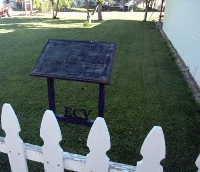
sectionhead>More about this marker. The marker is located in the lawn area west of the old Post Office.Please report objectionable advertising to the Editor.
Regarding Knights Landing. The Town
Knights Landing, built on a mound that marked the ancient meeting place of Native Americans inhabiting the region, and near the confluence of Cache Creek and the Sacramento River, was founded in 1843, by Dr. William Knight, a physician who was born in Baltimore, Maryland, in 1800. Knights Landing, the oldest town in Yolo County, rapidly became a shipping point on the river and “was once of the most noted points in the Sacramento Valley during and before the territorial era of California.” Early on, this steamboat landing became a place of importance for communication and transportation of goods for the people living on both sides of the Sacramento River. When the town was initially laid out, in 1849 it was called Baltimore, but disagreement over the sale of the new town’s lots caused that name to be discarded. It was subsequently called Grafton for a short while. Dr. Knight established a ferry here, which was later taken over by J. W. Snowball when he moved his family to Stanislaus County. The posted rates were one dollar for a man and his horse, and five dollars for a wagon.
In the 1850’s the new town grew, boasting a hotel run by S. R. Smith, and 1853 Charles
F. Reed surveyed and laid out a town site and the settlement officially became Knights Landing. That same year Captain .J. H. Updegraff opened his hotel, the Yolo House, with suitable fanfare and a grand New Year's party. Tickets were sold for ten dollars, and a steamer was run from Sacramento to the party for the convenience of his guests. The year 1853 also saw the opening of a large general merchandise store operated by J. W. Snowball and J. J. Perkins. By 1860, the Yolo House had been converted into a private residence which prompted entrepreneurs D. N. Hershey and George Glascock to build a brick hotel. In 1890 a branch of the Southern Pacific Railroad was constructed to the town. The railroad, and later the completion of a bridge crossing the Sacramento River, contributed greatly to the town’s prosperity
Once one of the most noted towns in the Sacramento Valley, today Knights Landing (population just under 900) is largely a town of farm workers and their families, but it seems to be on the cusp of a revival. In 2000 Gil Plubell, our host, purchased all of the old town including the old bank, the post office and two additional brick buildings and has spent the last fifteen years restoring and refurbishing them. According to Crafting and Valley Jewel by David L. Wilkins, the First National Bank building in Knights Landing was designed by William Henry Weeks in the Classical Revival style. It was decorated with exterior columns of “classical detailing (which) were constructed of terra cotta tile”. William R. Fait, a local building contractor, was involved in building the bank. In the post office, Gil has accumulated a collection of photos and other items that pertain to the town’s history. The cemetery, just south of town on County Road 102, is one of several purported final resting places of Charles Bolles, also known as Black Bart, the notorious stagecoach bandit. If he is interred there, the grave is unmarked. Although the town has seen better days, it is a busy little village sitting at the junction of three well-traveled roads, County Road 102 and State Routes 45 and 113 and appears to have a promising future.
The Man
William H. Knight was born in 1800 in Annapolis, Maryland and died on November 9, 1849 in Knights Ferry California. He was a practicing physician who had graduated in the study of medicine. He explored the west as a mountain man and fur trader. For a while, he lived in Santa Fe, where he became a Mexican citizen and met Carmen. The couple settled in the Cache Creek area in 1843 and William founded what would grow into a town on the Sacramento River
William and his wife Carmen played a vital role in the Bear Flag Revolt of June 1846, on e evening of June eighth, 1846 Carmen Knight obtained sensitive
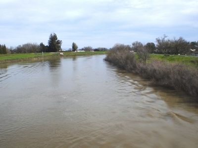
Photographed By Andrew Ruppenstein, February 28, 2009
4. Knights Landing - Looking Downstream from Sacramento River Bridge
In the above picture, the former location of the marker (by the guardrail) is barely visible, located on the right bank atop the levee. This is roughly the area where the landing would have been.
“gold fever” moved his family to a site on the Stanislaus River which was rich in gold and there, as he had done in Knights Landing, established a ferry crossing. Like many who went to the Mother Lode, William made more money from the miners who used his ferry than he made in the gold fields. Unfortunately, William was not destined to live into old age. On November 9, 1849, just months after he had founded a second town named after him, he was gunned down in the streets of Knights Ferry, a witness declaring that it was “one of the most cold blooded murders” he had witnessed. He is buried on a hill overlooking the Stanislaus River in a town he founded and in which he was killed.
The Plaque
In 1974, a revived Sam Brannan Chapter held its first function and plaque dedication in Knights Landing, a small town on the banks of the Sacramento River. The plaque was mounted on a concrete cube and mortared in place. In 1999 we returned to the site of our first function and re-dedicated the plaque on the occasion of our 25th anniversary, with Rich Benyo as our NGH. Humbug Bruce Frigard wanted to return for our 30th anniversary as well, but while planning for the event the Board discovered that the property was for sale and that the owners wanted the plaque removed. With the proper tools in hand, XNGH Rich Benyo, XNGH, Tom Crawford, and XSNGH, Loren Wilson travelled to Knights Landing, carefully removed the plaque, and delivered it to XNGH Bob Campbell who would fabricate a suitable structure upon which we could mount the plaque. When this was done, the plaque was re-located to a spot on the levee overlooking the Sacramento River, just a short distance from where it had been. It was in this location for our 30th anniversary Doin’s. A year or so ago the chapter received a communication from Gil Plubell, who told us that the plaque and mounting stand, had been uprooted and rolled down the levee, but that he had recovered it and would like to see it in stalled in a safer location on his property in Old Town, Knights Landing. He also offered to let us hold a function on his property to mark the relocation of this well-traveled plaque. We took him up on his offer, making this most likely, the only ECV plaque to have been placed in three different locations.
Additional commentary.
1. Additional Information on the Marker Dedication
Ron Kiehl was Noble Grand Humbug when this monument was erected. Plaque wording by Edward D Hawkins. Monument constructed by Robert M. Campbell.
— Submitted April 15, 2012, by Loren Wilson of Sebastopol, California.
Credits. This page was last revised on April 28, 2021. It was originally submitted on March 31, 2009, by Andrew Ruppenstein of Lamorinda, California. This page has been viewed 2,469 times since then and 111 times this year. Last updated on June 4, 2015, by Loren Wilson of Sebastopol, California. Photos: 1. submitted on April 20, 2015, by Loren Wilson of Sebastopol, California. 2. submitted on March 31, 2009, by Andrew Ruppenstein of Lamorinda, California. 3. submitted on April 20, 2015, by Loren Wilson of Sebastopol, California. 4. submitted on March 31, 2009, by Andrew Ruppenstein of Lamorinda, California. 5. submitted on April 15, 2012, by Loren Wilson of Sebastopol, California.
