New Castle in Craig County, Virginia — The American South (Mid-Atlantic)
New Castle
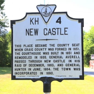
Photographed by J. J. Prats, May 30, 2015
1. New Castle Marker
Erected 1941 by Virginia Conservation Commission. (Marker Number KH-4.)
Topics and series. This historical marker is listed in this topic list: Political Subdivisions. In addition, it is included in the Virginia Department of Historic Resources (DHR) series list. A significant historical month for this entry is June 1864.
Location. 37° 30′ N, 80° 6.551′ W. Marker is in New Castle, Virginia, in Craig County. It is on Salem Avenue (Virginia Route 311) near Albert Street (County Route 634), on the left when traveling north. Touch for map. Marker is in this post office area: New Castle VA 24127, United States of America. Touch for directions.

Regionally, this marker is in the Mountain Region and in Southwest Virginia. It is also in the American South, specifically in the Upper South, in Appalachia, and specifically in Southern Appalachia. Globally, it is
this page online
Other nearby markers. At least 8 other markers are within 7 miles of this marker, measured as the crow flies: Revolutionary War Patriots (approx. ¼ mile away); Craig County Confederate Monument (approx. ¼ mile away); Craig County Veterans Monument (approx. ¼ mile away); Craig County World War Memorial (approx. ¼ mile away); Craig County World War II Memorial (approx. ¼ mile away); Holstine House (approx. 0.3 miles away); Craig Valley Branch Railroad (approx. 0.8 miles away); Great Eastern Divide (approx. 6.9 miles away). Touch for a list and map of all markers in New Castle.
Regarding New Castle. Wikipedia: New Castle (historically spelled as one word; “Newcastle”) is the only town in Craig County. The population was 153 at the 2010 census. It is the county seat.
Two notable geophysical features of the town are the high cliffs just
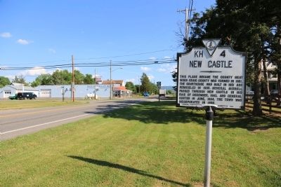
Photographed by J. J. Prats, May 30, 2015
2. New Castle Marker
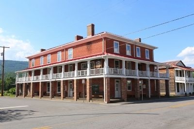
Photographed by J. J. Prats, May 30, 2015
3. The 1940 Old Brick Hotel
On Main and Court Streets, across from the courthouse.
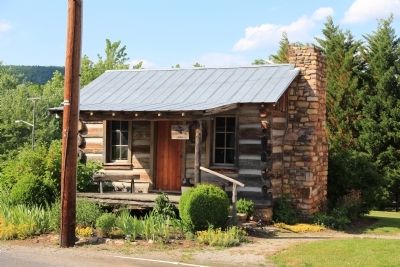
Photographed by J. J. Prats, May 30, 2015
4. One of the Log Houses In New Castle
On Court Street, next to the hotel.
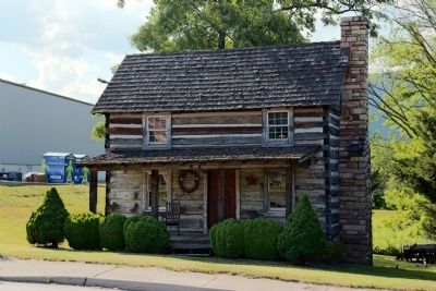
Photographed by J. J. Prats, May 30, 2015
5. Two Story Log House
On Market Street at Court Street, next to the supermarket.
Credits. This page was last revised on June 16, 2016. It was originally submitted on June 6, 2015, by J. J. Prats of Powell, Ohio. This page has been viewed 1,055 times since then and 60 times this year. Last updated on June 6, 2015, by J. Makali Bruton of Washington, District of Columbia. Photos: 1, 2, 3, 4, 5. submitted on June 6, 2015, by J. J. Prats of Powell, Ohio. • Bill Pfingsten was the editor who published this page.
