Near Belkıs in Serik, Antalya, Turkey — West Asia or Southeast Europe
Aspendos
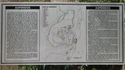
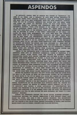
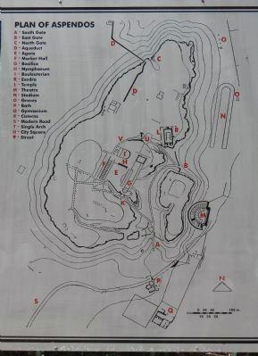
In antiquity, central part of Antalya was known as Pamphylia, the land of all tribes, and is thought to have been settled originally by migrating people from Anatolia. Pamphylia grew into a populous region and many fine cities were established. None was more impressive, however, than the city of Aspendos. Aspendos was divided into two areas; upper and lower. The lower city provided access for busy river traffic, and contained mainly the shipping and commercial areas and probably the residential districts. Today, little remains of the lower city. The upper city, or the Acropolis, spread over a flat topped hill, rising about 60 meters above the right bank of the Köprüçay River (The ancient river Eurymedon) and 20 hectares in extent. It was part surrounded by the city walls and along the walls three monumental city gates were built. The Acropolis area holds most of the monumental buildings and public areas which can be seen today. Like neighboring Perge to the west, Aspendos was engulfed in many historical battles and changes of sovereignty, including Alexander the Great in 333 B.C. Aspendos was even part of the Pergamon kingdom until 133 B.C. Like most other Pamphylian cities, Aspendos reached its Golden Age during the second and third centuries A.D., when most of its monumental buildings, the basilica, the fountain and the aqueducts were built. After the fall of the Roman empire, the city experienced a massive earth quake and suffered attacks from marauding pirates, disease and famine, and eventually fell into decline after the 7th century.
Owing to the Eurymedon river, a navigable waterway in ancient times, Aspendos grew into a important commercial center in Pamphylia. It is thought nearly 20,000 people lived and worked in Aspendos. Fertile agricultural plains, olive groves, vineyards and salt beds, as well as grain exports and horse-breeding all played a major role in making Aspendos one of Pamphylias wealthiest cities. Major exports included hand-woven rugs, leavings and textiles, furniture made from lemon tree wood and highly regarded wines. Perhaps the most famous export of all was Aspendian horses. So legendary were Aspendian horses, that Alexander the Great levied a tax on the city payable in 4,00 horses yearly. Testifying to the wealth and importance of Aspendos, its coins were minted with the citys original Anatolian name, Estfediiys and two naked wrestlers, the citys symbol. The silver coins were highly valued throughout the Mediterranean region.
Before the aqueduct was built the citys water needs were met either from the wells in the plains of from the pear-shaped cisterns on the Acropolis. To bring water to the city by means of a water way carried on arches and two pressure towers under the ordinary atmospheric pressure was one of the most common and important aspects of Roman architecture.
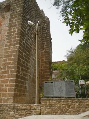
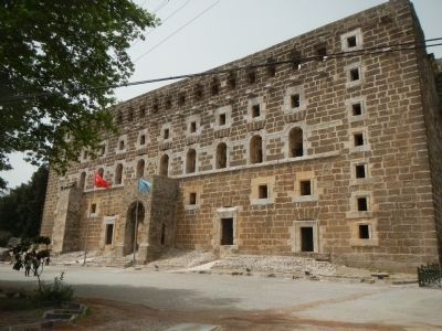
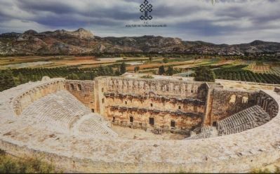
The Aspendos theater is the best preserved Roman theater of the ancient world. Inscriptions on the south main entrance show the theater was constructed during the region (sic, reign) of Emperor Marcus Aurelius (161-180 A.D.). Its architect was Zenon, a local Aspendian; its construction was funded and presented to the city by two brothers, Crispinus and Auspicatus Curtius, who dedicated it to the Imperial family and city gods. The dedication inscription can still be seen outside the main entrance, but today is only partially readable.
During the thirteenth century, the Seljuk Sultan, Alaeddin Keykubat I, thoroughly restored the theater, embellished it with elegant cobalt blue Seljuk tile work, and used it for a summer residence. This magnificent theaters acoustics were famous from the day it was presented to the present day. The theater is still in use today, seating thousands of people, and hosting major events such as operas, concerts and folklore festivals.
Turkish:
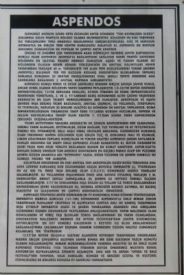
Günümüz Antalya ilinin orta kesimleri anti̇k dönemde "tüm kavimlerin ülkesi"anlamına gelen Pamfilya bölğesi olarak bilinmekteydi. bölgenin en eski tarihi̇inde ilk yerleşimlerin yerli anadolu halklarınca gerçekleştirildiği, göç ve nüfusun artmasıyla da birçok yeni kentin kurulduğu anlatılır ki, Aspendos bu kentler arasında günümüzün en popüler ve çarpıcı anti̇k kenti̇di̇r.
Ününü ve önemini çok yakınından akan köprüçayı nehrine (antik_Eurymedon) borçlu olan Aspendos akdeniz'le bağlantısinı saglayan nehir trafiǧi sayesinde bölgeni̇n en işlevsel ti̇caret merkezi̇ olmuştur aşağı ve yukarı olarak i̇ki̇ bölümden oluşan nehir kenarı yerleşi̇mini̇n en anıtsal kalıntıları nehir yatağından yaklaşık 60 m. yükseklikte yer alan tepe düzlüğündeki̇ yukarı şehirde (akropol) bulunur yer yer düzgün kesilmiş dikdörtgen bloklardan yapılmış surlarla korunan 20 hektar genişliğindeki oval şeki̇lli tepeye birbirine ana caddelerle bağlanan 3 anıtsal kapıdan girilmekteydi.
Aspendos komşu Perge ve diğer şehirlerle beraber birçok savaşa sahne olmuş, ancak genel olarak bölgenin tarihi kaderini paylaşmıştır. i̇.ö.333'de büyük iskender imparatorluğu, 133'de Bergama krallığı, 43'den i̇itibaren de Roma İmparatorluǧu idaresinde yönetılmış, 2. ve 3. y.y.'lardaki barış dönemi̇nde altın çağını yaşayarak akdeniz'in en i̇şlek ti̇caret merkezlerinden biri olmuştur. akropolde ve aşağı şehirde inşa edilmiş ticari bazilika(g), anıtsal çeşme(h), su yollari(d), stadyum(n) ve tiyatro(m), nüfusun 20 bi̇nlere ulaşığı bu dönemin en anıtsal yapılarıdır. Roma Imparatorluğunun yıkılmasını takip eden y.y.'larda korsan hücumları, deprem ve salgın hastalıklarla tahrip olan kenti̇n 7. y.y.'dan sonra tarih sahnesinden çekildiği düşünülmektedir.
Ticari aktivitenin yanısıra akdeniz'in en zengi̇n kentlerinden biri olmasında; veri̇mli̇ tarım alanları, zeytinlikler, üzüm bağları, tuz yatakları ve at yetiştiriciliği önemli rol oynamıştır. belli başlı ihraç ürünleri̇ arasında; günümüzde kurumuş olan yakındaki kapria gölünden elde edi̇len tuz, el dokuması hali ve ki̇li̇mler, li̇mon ağacından yapılmış mobilyalar ve yüksek kali̇teli̇ Aspendos şarabı sayılabilir. Bunlar arasında ilk sırayı ünlü Aspendos atları almaktaydı kı, büyük iskender'in şehri yılda 4000 atlık vergiye bağlaması bunun en somut kanıtıdır. Aşpen dos'ta basılan gümüş sikkeler tüm akdeniz dünyasının en geçerli parası olup bir yüzunde şehrin özgün anadolu adı "Estfedııys" yazısı, diğer yüzünde ıse şehrin sembolu iki güreşçi figürü yer almıştır.
Kalıntılar arasındaki en eski anıtsal yapı akropolün kuzey-dogu terasında ana kaya üzerine kurulmuş dor düzeni̇ndeki küçük boyutlu tapınaktır (l). tiyatrodan en az 400 yıl önce inşa edilmiş olup (i.o.3.y.y) günümüze sadece temelleri kalabilmiştir. Su yollarının inşasından önce ana kayaya oyulmuş yaklaşık 5 m. derinlikteki armut şekilli sarnıçlarla (r). şehrin su ihtiyacı önemli ölçüde sağlanabilmiştir. 2.y.y.'ın sonlarında inşa edi̇len su yolları ile toros daǧlarındaki kaynağından şehre kazandırılan su, normal atmosfer basıncı altında, i̇ki̇ basınç kulesiyle su ulaşımının en çarpıcı mühendisli̇k örnegidir.
Aspendos tiyatrosu antik dünyanın
en iyi korunmuş Roma dönemi tiyatrosudur. Imparator Markus Aurelıus (161-180) döneminde Aşpendos'lu_ünlü mi̇mar Zenon tarafından planlanıp Crispinus ve Auspicatus Curtius adlı i̇ki kardeş tarafından inşa ettirip İmparator ailesi ve şehrin tanrılarına adandıǧı ana ği̇ri̇şleri̇n üzerindeki kısmen okunabilen yazıtlardan anlaşılmaktadır. Yapın malzemesi olan
konglomera ve kireç taşı blokları toros dağlarındaki en yakin ocaklardan,
dekorasyon malzemesi̇i mermer ise afyon iscehisai'dan (antik dokimeion)
getirilmiştir en üst kemerli galerinin 5 destegi ile blok araliarındaki
sağlamlaştırma çalışmaları dışında onarım görmeden özgün haliyle günümüze kalabilmiş tek tiyatrodur.
13.y.y.'da büyük Selçuklu Sultanı Alaaddin Keykubat tarafından onarılarak nadide Selçuk çinileriyle bezenen sahne binası bir süre sultanin yazlık konutu olarak kullanılmıştır. mi̇mari̇ mükemmelliğinin yanında akustiği ile de unlu olan Aspendos ti̇yatrosu 1930 yılından itibaren büyük önderi̇miz Mustafa Kemal Atatürk'ün buyruklarıyla ziyarete açılmıştır. ünü her yıl artan "opera ve bale festivali"ni̇n yanında; halk dansları, konser ve benzeri sosyal ve kültürel etkinliklerle de bi̇nlerce konuğa ev sahipliği yapmaktadır.
Topics. This historical marker is listed in these topic lists: Arts, Letters, Music • Entertainment • Settlements & Settlers.
Location. 36° 56.362′ N, 31° 10.361′ E. Marker is near Belkıs, Antalya, in Serik. Marker can be reached from Aspendos Yolu, on the right when traveling north. Touch for map. Marker is in this post office area: Belkıs, Antalya 07400, Turkey. Touch for directions.
Other nearby markers. At least 1 other marker is within walking distance of this marker. The Theatre of Aspendos (a few steps from this marker).
Credits. This page was last revised on February 2, 2022. It was originally submitted on June 7, 2015, by Barry Swackhamer of Brentwood, California. This page has been viewed 586 times since then and 16 times this year. Photos: 1, 2, 3, 4, 5, 6, 7. submitted on June 7, 2015, by Barry Swackhamer of Brentwood, California. • Andrew Ruppenstein was the editor who published this page.
