Early Families Here
⎯⎯⎯
Early South Frankfort
![Early Families Here Marker [front] image. Click for full size.](Photos3/310/Photo310667.jpg?68201513400PM "Early Families Here Marker [front]. Click for full size.")
Early Families Here
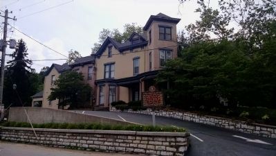
Owners whose families lived in the original house here - J.W. Denny, State Attorney General; Thomas Loughborough and son Judge Preston Loughborough, Chief U.S. Postal Inspector; Sally S. Jouett, widow of Colonel William R. Jouett; and Thomasine Jouett, granddaughter of Revolutionary War hero Jack Jouett. This Queen Anne house was built by John Meagher, 1889-90.
Early South Frankfort
This site is part of 500-acre land grant (1782) to Revolutionary War soldier George Campbell, who served with George Rogers Clark. Property has been owned by notable persons including early legislators Otho Beatty, William Murray and Baker Ewing; State Auditor Thomas Page; and lawyer philanthropist John Hanna. South Frankfort, a separate town 1810-50, included most of Campbell survey.
Erected 1982 by Kentucky Historical Society, Kentucky Department of Highways. (Marker Number 1707.)
Topics and series. This historical marker is listed in these topic lists: Architecture • Settlements & Settlers • War, US Revolutionary. In addition, it is included in the Kentucky Historical Society series list.
Location. 38° 11.702′ N,
this page online

Regionally, this marker is in Kentucky’s Bluegrass Region. It is also in the American South and specifically in the Upper South. Globally, it is in North America, the Western Hemisphere, the Western World, and the Anglosphere. Historically, it finds itself in what was once the territory of the Mississippian Culture and also the Antebellum South.
Other nearby markers. At least 8 other markers are within walking distance of this marker: The Ford - Natcher Floodwall (about 700 feet away, measured in a direct line); Frankfort Bridge Site (approx. 0.2 miles away); Good Shepherd Church (approx. 0.2 miles away); Paul Sawyier Library (approx. 0.2 miles away);
![Early South Frankfort Marker [reverse] image. Click for full size.](Photos3/310/Photo310668.jpg?68201513600PM "Early South Frankfort Marker [reverse]. Click for full size.")
Credits. This page was last revised on September 17, 2020. It was originally submitted on June 8, 2015, by Dave Knoch of Scott County, Kentucky. This page has been viewed 513 times since then and 27 times this year. Photos: 1, 2, 3. submitted on June 8, 2015, by Dave Knoch of Scott County, Kentucky. • Bill Pfingsten was the editor who published this page.
