Near Acarlar in Selçuk, Izmir, Turkiye — West Asia or Southeast Europe
The Bouleuterion
Bouleuterion
Photographed by Barry Swackhamer, May 2, 2015
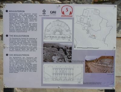
1. The Bouleuterion Marker
Captions (English / Turkish): The state of the auditorium (1908) / Odltoryumun 1908'deki durumu; Reconstruction of the 2nd century A.D. stage wall / İ.S. 2. yüzyıla at sane duvarının rekonstrüksiyonu
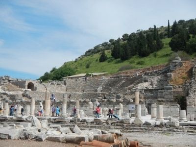
The Bouleuterion housed the meetings of the council (boule) as well as musical performances and contests. The originally roofed semi-circular auditorium is bonded to a stage wall. The building was erected around A.D. 100. In A.D. 150, Publius Vedius Antoninus sponsored a new stage building which displayed a portrait gallery of the Imperial family and letters of Emperor Antoninus Pius (A.D. 138-161).
Turkish:
Bouleuterion, kent meclisinin (boule) oturumlarına ev sahipliği yaptığı gibi, müzik gösterileri ve” yarışmaların da yapıldığı bir mekandı. Ozgün halinde üzeri kapalı olan, yarım daire biçimindeki oditoryum (dinIeme/-izleme salonu) bir sahne duvarı ile bağlanmıştır.
Yaklaşık olarak I.S. 100'de inşa edilmiş olan bina, I.S. 150 civarında Publius Vedius Antoninus tarafından bağışlanan yeni bir sahne duvarına kavuşmuştur, bu duvarda imparator ailesinin portreleri ve Imparator Antoninus Pius'un (İ.S. 138-161) mektupları sergilenmekteydi.
German: To read the German text, click on the marker image to enlarge it.
Erected by Kültür
this page online
Topics. This historical marker is listed in this topic list: Settlements & Settlers.
Location. 37° 56.2′ N, 27° 20.695′ E. Marker is near Acarlar, Izmir, in Selçuk. It can be reached from Efes Yolu close to Dr. Sabri Yayla Boulevard (Izmir Route D515). Touch for map. Marker is in this post office area: Acarlar, Izmir 35920, Turkiye. Touch for directions.

Regionally, this marker is in Turkish Asia Minor — Anatolia. Globally, it is in West Asia, Mesopotamia, and in a coastal Mediterranean country. Historically, it finds itself in what was once the Byzantine Empire, the Ottoman Empire, and specifically the Roman Empire.
Other nearby markers. At least 8 other markers are within walking distance of this marker: The 'State Agora' (within shouting distance of this marker); Processional Way (within shouting distance of this marker); The 'Rhodian Peristyle' and The Prytaneum (within shouting distance of this marker); Baths at the 'State Agora' (within shouting distance of this marker); Temple on the 'State Agora'
Photographed by Barry Swackhamer, May 2, 2015
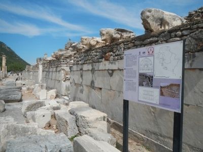
2. The Bouleuterion Marker
More about this marker. This marker is on the grounds of the Roman city of Ephesus (Efes) ruins.
Photographed by Barry Swackhamer, May 2, 2015
3. The Bouleuterion
Credits. This page was last revised on February 2, 2022. It was originally submitted on June 11, 2015, by Barry Swackhamer of Brentwood, California. This page has been viewed 682 times since then and 14 times this year. Photos: 1, 2, 3. submitted on June 11, 2015, by Barry Swackhamer of Brentwood, California. • Andrew Ruppenstein was the editor who published this page.
