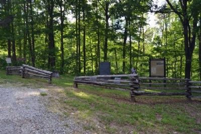
Near East Bernstadt in Laurel County, Kentucky — The American South (East South Central)
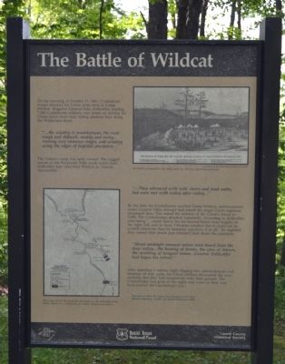
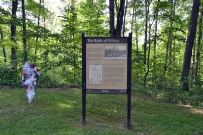
The Battle of Wildcat
“... the country is mountainous, the road rough and difficult, muddy and rocky, running over immense ridges, and winding along the edges of frightful precipices ...”
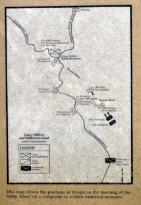
The Unionís camp was aptly named. The rugged terrain of the Rockcastle Hills made travel hard. Zollicoffer later described Wildcat as “almost inaccessible.”
“... They advanced with wild cheers and loud oaths, but were met with volley after volley ...”
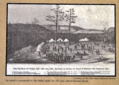
By the time the Confederates reached Camp Wildcat, reinforcements under General Albin Schoepf had joined the single Union regiment encamped here. This raised the number of the Unionís forces to 5,000. The Confederates attacked repeatedly. According to Zollicoffer, after being “... under heavy fire for several hours from heights on the right, left, and in front, I became satisfied that it could not be carried otherwise than by immense exposure, if at all.” By nightfall, they ceased their attack and retreated back down the mountain.
“About midnight unusual noises were heard from the deep valley ... the beating of drums, the cries of drivers, the rumbling of (wagon) trains ... General Zollicoffer had begun his retreat.”
After spending a restless night digging new entrenchments and sleeping on their guns, the Union soldiers discovered the next morning that they had successfully held their ground. The Confederates had gone in the night, and were on their way back toward the Cumberland Gap.
Quotations from the regimental history of the 33rd Indiana Infantry, written by David Stevenson, 1864.
Erected by Daniel Boone National Forest and Laurel County Historical Society.
Topics. This historical marker is listed in this topic list: War, US Civil. A significant historical date for this entry is October 21, 1861.
Location. 37° 15.921′ N, 84° 12.085′ W. Marker is near East Bernstadt, Kentucky, in Laurel County. Marker is at the intersection of Old Wilderness Road and Camp Wildcat Road (Sheltowee Trace), on the right when traveling north on Old Wilderness Road. Marker is located near the Camp Wildcat Battlefield. Directions to the battlefield are clearly marked from both Interstate 75 (Exit 49) and US Route 25. Touch for map. Marker is in this post office area: East Bernstadt KY 40729, United States of America. Touch for directions.
Other nearby markers. At least 8 other markers are within 3 miles of this marker, measured as the
crow flies. Camp Wildcat (here, next to this marker); Nerve Center for the Union Army (about 300 feet away, measured in a direct line); Battle of Camp Wildcat (about 500 feet away); a different marker also named Battle of Camp Wildcat (about 500 feet away); Camp Wildcat and the Wilderness Road (approx. 0.4 miles away); Skaggs Trace (approx. 1.9 miles away); a different marker also named Camp Wildcat (approx. 2.2 miles away); Congressional Medal of Honor (approx. 2.4 miles away). Touch for a list and map of all markers in East Bernstadt.
Also see . . .
1. Battle of Camp Wildcat - Wikipedia entry. (Submitted on June 13, 2015.)
2. Camp Wildcat Preservation Foundation. Official website of the organization preserving the battlefield and making visitor improvements to the site. (Submitted on June 13, 2015.)
Credits. This page was last revised on June 16, 2016. It was originally submitted on June 13, 2015, by Duane Hall of Abilene, Texas. This page has been viewed 516 times since then and 22 times this year. Photos: 1, 2, 3, 4, 5. submitted on June 13, 2015, by Duane Hall of Abilene, Texas.
