Piermont in Rockland County, New York — The American Northeast (Mid-Atlantic)
“Watchfires”
Photographed by Michael Herrick, June 13, 2015
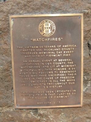
1. “Watchfires” Marker
The Vietnam Veterans of America, Chapter 333, Rockland County observes Memorial Day every May 30th at Piermont Pier
An annual event at several locations in our country; the “Watchfires” are lit at midnight with full military honors. A 24 hour vigil follows to remember those who have sacrificed their lives in the cause of freedom and democracy in all the wars and conflicts throughout our nation’s history.
This area has been dedicated in perpetuity for that purpose by the Village of Piermont
May 30th, 2000
Erected 2000.
Topics. This memorial is listed in this topic list: Military. A significant historical date for this entry is May 30, 1985.
Location. 41° 2.581′ N, 73° 53.809′ W. Memorial is in Piermont, New York, in Rockland County. It is on Ferry Road one mile east of Pier Street when traveling east. Located at the end of Piermont Pier. Touch for map. Memorial is in this post office area: Piermont NY 10968, United States of America. Touch for directions.

Regionally, this memorial is in the Hudson Valley and in the New York City Metropolitan Area. It is also in the American Northeast, in the Mid-Atlantic,
this page online
Other nearby markers. At least 8 other markers are within one mile of this marker, measured as the crow flies: Piermont Pier (here, next to this marker); Bogertown (approx. 0.9 miles away); The Flywheel: A Monument to Piermont's Industrial Past (approx. 0.9 miles away); Sneden House (approx. one mile away); Roll of Honor (approx. one mile away); Last Stop U.S.A. (approx. 1.1 miles away); The Tappan (approx. 1.1 miles away); Bridge Street Bridge Over The Sparkill Creek (approx. 1.1 miles away). Touch for a list and map of all markers in Piermont.
Also see . . . Vietnam Veterans of America Chapter 333. Chapter Website honepage (Submitted on June 15, 2015, by Michael Herrick of Southbury, Connecticut.)
Photographed by Michael Herrick, June 13, 2015
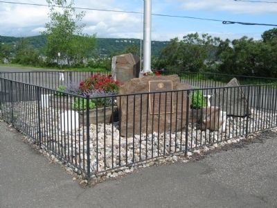
2. “Watchfires” Marker
Photographed by Michael Herrick, June 13, 2015
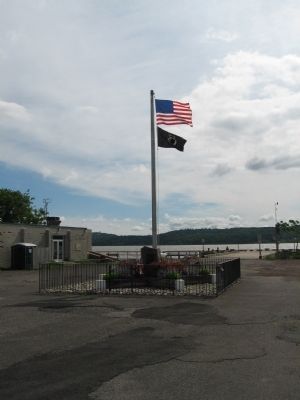
3. Flags and Markers at the end of the Piermont Pier
Credits. This page was last revised on March 25, 2021. It was originally submitted on June 15, 2015, by Michael Herrick of Southbury, Connecticut. This page has been viewed 619 times since then and 29 times this year. Photos: 1, 2, 3. submitted on June 15, 2015, by Michael Herrick of Southbury, Connecticut.
