Near Greenwater in Pierce County, Washington — The American West (Northwest)
Mud on the Move
Osceola Mudflow
— Mather Memorial Parkway —
Inscription.
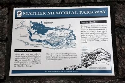
Mud on the Move. Along with lava and ash, the
volcanically active Mount Rainier has contributed thick flows of mud from its sides and summit. One of the largest mudflows occurred about 5,800 years ago sending thick rivers of mud down the White River drainage.
These flows carried rock and huge boulders, some 35 feet tall and several hundred feet around, from the mountain’s slopes to the surrounding lowlands.
Osceola Mudflow. The largest of the mountain’s historic flows, the Osceola mudflow covered an area of about 100 square miles. It buried the present town site of Enumclaw (24 miles west of here) under as much as 70 feet of debris.
Seismic activity triggered the mudflow, resulting in the collapse of nearly 2,000 feet of Mt. Rainier’s summit.
Erected by Mt. Baker-Snoqualmie National Forest.
Topics. This historical marker is listed in this topic list: Natural Features.
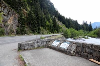
Location. 47° 3.166′ N, 121° 34.325′ W. Marker is near Greenwater, Washington, in Pierce County. Marker is on Chinook Pass Highway (State Highway 410) 7½ miles south of Greenwater, on the right when traveling west. It is at the scenic pulloff. Touch for map. Marker is in this post office area: Enumclaw WA 98022, United States of America. Touch for directions.
Other nearby markers. At least 1 other marker is within walking distance of this marker. Why is the River White? (here, next to this marker).
Credits. This page was last revised on June 16, 2016. It was originally submitted on June 15, 2015, by J. J. Prats of Powell, Ohio. This page has been viewed 337 times since then and 9 times this year. Photos: 1, 2, 3. submitted on June 15, 2015, by J. J. Prats of Powell, Ohio.


