Near Çandir in Köycegiz, Muǧla, Turkey — West Asia or Southeast Europe
The Domed Church
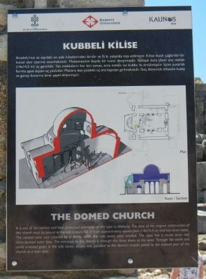
Kubbeli Kilise
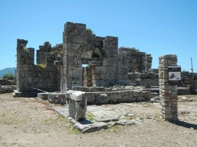
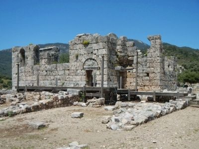
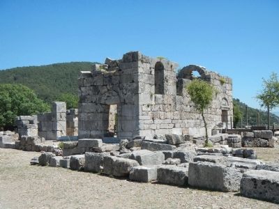
It is one of the earliest and best preserved of its type in Anatolia. The date of the original construction of this church must be placed at the 6th century AD. It is an approximately square plan (14 x 14.5 m) and has three naves. The central nave was covered by a dome, while the side naves were vaulted. The apse has a round inner and three-faceted outer face. The entrance to this church is through the three doors at the west. Through the north and south oriented gates in the side naves, access was provided to the domed chapels joined to the eastern part of the church at a later date.
Turkish:
Anadolu'nun az sayıdaki en eski kiliselerinden biridir ve İS 6. yüzyılda inşa edilmiştir. Kilise klasik çağlardan bir kutsal alan üzerine oturmaktadır. Malzemesinin büyük bir kısmı devşirmedir. Yaklaşık kare planlı ana mekân (l4 x l4.5 m) üç gemilidir. Yan mekanların her biri tonoz., orta mekân ise kubbe ile örtülmüştür. İçten yuvarlak formlu apsis dıştan üç yüzlüdür. Mekâna batı yüzdeki üç ana kapıdan girilmektedir. Geç dönemde kilisenin kuzey ve güney duvarına birer şapel eklenmiştir.
Erected by Kültür ve Turizm Bakanlıǧı and Başkent Üniversitesi.
Topics. This historical marker is listed in these topic lists: Churches & Religion • Settlements & Settlers.
Location. 36° 49.574′ N, 28° 37.331′ E. Marker is near Çandir, Muǧla, in Köycegiz. Marker is on Isimsiz Yol. Touch for map. Marker is in this post office area: Çandir, Muǧla 48800, Turkey. Touch for directions.
Other nearby markers. At least 4 other markers are within walking distance of this marker. The Roman Bath (within shouting distance of this marker); Theater (about 120 meters away, measured in a direct line); Theater Fountain (about 120 meters away); Caunus (approx. 0.4 kilometers away).
More about this marker. This marker is located among the ruins of the Roman city of Caunus (Kaunos). Access to Caunus by road is available from Köyceǧiz via Hamilköy and Sultananiye. However, it is much easier to take a water taxi from the river front in downtown Dalyan.
Credits. This page was last revised on February 1, 2022. It was originally submitted on June 21, 2015, by Barry Swackhamer of Brentwood, California. This page has been viewed 354 times since then and 5 times this year. Photos: 1, 2, 3, 4. submitted on June 21, 2015, by Barry Swackhamer of Brentwood, California. • Andrew Ruppenstein was the editor who published this page.


