Near Williamsport in Hickman County, Tennessee — The American South (East South Central)
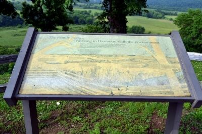
The Family Farm ... Working in Harmony with the Environment
Inscription.
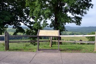
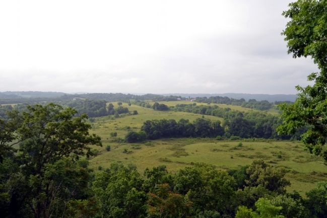
The Morrow family farm, visible from this outlook, is an excellent example of agriculture working in harmony with the environment. The Morrow’s, like other conservation farmers, have a strong conservation ethic and a desire to leave improved soil and water resources for the next generation. Conservation measures illustrated in this display are the tools of caring stewards of the land.
Farm ponds provide water for livestock, prevent streambank erosion, and provide a habitat for fish and wildlife, provide recreation opportunities, and add to the scenic beauty of the world around us.
Agriculture can co-exist with wildlife by providing wildlife habitat areas that provide food and shelter for wildlife. Agriculture works with the environment by considering all that is part of nature.
Pastureland must be managed to prevent erosion and overgrazing. Conservation works to maintain and restore pasture cover which improves the soil resource.
Grassed waterways prevent gullies from forming while directing water safely across the land with minimal soil erosion.
Conventional tillage (turning the soil) leaves the soil unprotected from wind and water. Conservation tillage uses as little disturbance of the soil as practical and residue from previous crops to protect the soil. Reducing erosion protects the soil and improves water quality.
The man-made scars of mining, visible even from a distance, blemish the landscape and are a threat to water quality and the environment. Reclamation efforts heal the land and renew the rural landscape.
Filter strips remove sediment and other pollutants from runoff before the water reaches adjacent streams, ponds, and lakes. Filter strips are used as borders for the cropped fields that are adjacent to Duck River.
(First sentence illegible)
Clean water is a necessity for everyone. Water management and conservation practices enable farmers to protect and improve the quality of our water. The efforts toward water quality on the farm benefit even our most urban citizens. Ultimately we all drink from the same container–planet earth.
Erected by A. Manson Morrow II, Conservation Farmer, Maury County Soil Conservation District, Soil Conservation Service, and National Park Service.
Topics and series. This historical marker is listed in this topic list: Environment. In addition, it is included in the Natchez Trace series list.
Location. 35° 41.886′ N, 87° 17.262′ W. Marker is near Williamsport, Tennessee, in Hickman County. Marker can be reached from Natchez Trace Parkway
(at milepost 405.1), 2.7 miles south of Williamsport Pike (Tennessee Route 50), on the right when traveling north. Marker is located at the Baker Bluff Overlook turnout. Touch for map. Marker is in this post office area: Duck River TN 38454, United States of America. Touch for directions.
Other nearby markers. At least 8 other markers are within 3 miles of this marker, measured as the crow flies. Welcome! (approx. 0.3 miles away); Highland Rim Section (approx. 0.3 miles away); Natchez Trace Parkway (approx. 0.3 miles away); Jackson Branch – A Stolen Stream (approx. 0.4 miles away); Old Trace Walk (approx. 1.3 miles away); Old Well Cemetery (approx. 1.7 miles away); The Gordon House (approx. 2.1 miles away); a different marker also named The Gordon House (approx. 2.2 miles away). Touch for a list and map of all markers in Williamsport.
Also see . . . Natchez Trace. Official National Park Service website. (Submitted on June 21, 2015.)
Credits. This page was last revised on June 16, 2016. It was originally submitted on June 21, 2015, by Duane Hall of Abilene, Texas. This page has been viewed 439 times since then and 10 times this year. Photos: 1, 2, 3, 4. submitted on June 21, 2015, by Duane Hall of Abilene, Texas.


