Springfield Township near East Springfield in Erie County, Pennsylvania — The American Northeast (Mid-Atlantic)
Old State Line
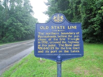
Photographed by Mike Wintermantel, June 27, 2015
1. Old State Line Marker
Erected 1946 by Pennsylvania Historical and Museum Commission.
Topics and series. This historical marker is listed in this topic list: Notable Places. In addition, it is included in the Pennsylvania Historical and Museum Commission (PHMC) series list. A significant historical year for this entry is 1792.
Location. 41° 59.986′ N, 80° 24.333′ W. Marker is near East Springfield, Pennsylvania, in Erie County. It is in Springfield Township. It is at the intersection of West Lake Road (Pennsylvania Route 5) and Happy Valley Road, on the right when traveling east on West Lake Road. Touch for map. Marker is in this post office area: North Springfield PA 16430, United States of America. Touch for directions.

Regionally, this marker is
this page online
Other nearby markers. At least 8 other markers are within 7 miles of this marker, measured as the crow flies: Abraham Lincoln in Lake City, PA (Girard Station) (approx. 3.3 miles away); Erie County Soldiers' Monument (approx. 4½ miles away); About This Stone Pillar (approx. 4½ miles away); Circus History (approx. 4.6 miles away); Charlotte Elizabeth Battles (approx. 4.6 miles away); Veterans Memorial (approx. 5.1 miles away); Erie Extension Canal (approx. 5.2 miles away); PA-OH Border Monument
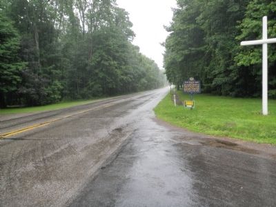
Photographed by Mike Wintermantel, June 27, 2015
2. Old State Line Marker
Also see . . . Wikipedia entry for Erie Triangle. Of the four competing claimants (Pennsylvania, New York, Connecticut, and Massachusetts), only Pennsylvania was landlocked. Following some pressure from the new federal government, all four states surrendered their claims to the U.S., which then, in 1792, turned around and sold final rights to Pennsylvania for 75¢ per acre. (Submitted on June 28, 2015.)
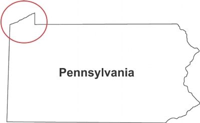
3. The Erie Triangle on Pennsylvania's Northwestern Edge
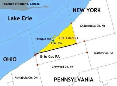
Via Wikipedia by Jengod, derived from Rmhermen, January 10, 2005
4. Map of Erie Triangle in Erie County, Pennsylvania and surrounding area
Credits. This page was last revised on April 11, 2023. It was originally submitted on June 27, 2015, by Mike Wintermantel of Pittsburgh, Pennsylvania. This page has been viewed 3,516 times since then and 209 times this year. It was the Marker of the Week June 28, 2015. Photos: 1, 2. submitted on June 27, 2015, by Mike Wintermantel of Pittsburgh, Pennsylvania. 3, 4. submitted on June 28, 2015.
