Cankurtaran in İstanbul in Fatih, Turkey — West Asia or Southeast Europe
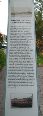
Marmara Land Walls (Theodosian Walls)
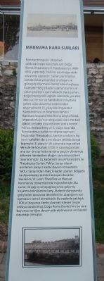
Marmara Kara Surları
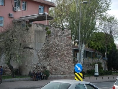
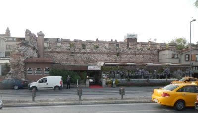
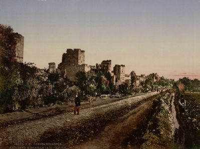
They are the defensive structures, 7620 m in length, built by the decree of the Emperor of the Eastern Roman Empire Theodosios II (408- 450), to protect Constantinople from hostile attacks. The walls border the peninsula on the West (in the land direction) and starting from the Marmara Sea on the South, extend to the Golden Horn on the North. Land walls are constructed in a three layer defense system which consists of the main wall built on natural topographical curves, front walls and the moats. After the Emperor Constantine the Great reconstructed Byzantium as the Eastern administrative center of the Roman Empire with the name Constantinople/Nova Roma in the IV. century, the city population boomed and Constantinople grew out of the Walls of Constantine in the beginning of the 5th century. Emperor Theodosius moved the city borders to the West, to include the newly formed neighborhoods.The main walls, 5700 m in length, protected by 96 towers, built in the first half of the 5th century, front wall line and the moats which were added later form the defensive system. The three layered defensive system, Theodosius Walls extend until the Palace of the Porphyrogenitus. The walls which protect the Ayvansaray neighborhood in the area from the Palace of the Porphyrogenitus, to the Golden Horn are built in the periods of Heraclius, Leon VI, Theophilos and Manuel I Komnenos. These walls represent the latest stage of defensive techniques developed in the Mediterranean world against the siege techniques of the antiquity and medieval periods. They stopped many armies for around a millennium, being one of the most important basis of the persistence of the Eastern Roman Empire for this long period.
Turkish:
Konstantiopolis'i düşman saldırılarından korumak için Doǧu Roma İmparatoru II. Theodosios'un (408- 450) yaptırdığı 7620 m uzunluǧundaki savunma yapısıdır. Surla; yarımadayı batıda (kara yönünde) sınırlayan ve güneyde Marmara Denizi'nden başlayıp kuzeyde Haliç'e kadar uzanan surları, yakın çevresini içermektedir. Kara surları, doğal topografik eğriler üzerinde yer alan ana sur, ön sur ve hendekten meydana gele üçlü savunma sisteminden oluşmaktadır. lV. yüzyılda Imparator Konstantinus'un Bizantion kentini Konstantinopolis/Nea Roma adıyla Roma İmparatorluğu'nun doğudaki idari merkezi olarak yeniden inşa ettikten sonra kentin nüfusu hızla artmış ve 5. yüzyıl başında Konstantinus surlarının dışına taşmıştır. İmparator Theododius, kentin sınırlarını bu yeni mahalleri de içine alacak şekilde batıya taşımıştır. 5. yüzyılın ilk yarısında inşa edilen 96 kule ile korunan, 5700 m uzunluğundaki ana sur- ön sur hattı ve daha geç bir dönemde eklenen hendekten oluşan savunma sistemi tasarlanmıştır. Üç kademeli savunma sistemi ile Theodosius SurIarı,Tekfur Sarayı olarak isimlenen Saray'a kadar devam etmektedir. Tekfur Sarayı'ndan HaIiç'e kadar uzanan bölgede ise Ayvansaray semtini koruyan duvarlar, Heraklios, VI. Leon,TheofiIos ve Manuel Komnenos dönemlerinde inşa edilmiştir. Bu surlar, ilk çağ ve ortaçağ boyunca gelişmiş kuşatma tekniklerine karşı Akdeniz dünyasında geliştirilen savunma tekniklerinin ulaştığı en son aşamasını temsil etmektedir. Bu nedenle yaklaşık 1000 yıl boyunca kente ulaşmak isteyen birçok orduyu durdurmuş, Doğu Roma Devleti'nin bu süre boyunca varlığını devam ettirebilmesinin en önemli dayanağı olmuştur.
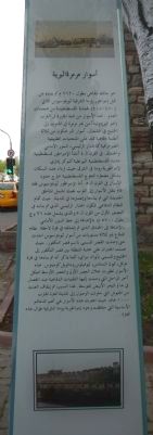
Arabic: To read the Arabic text, click on the Arabic image to enlarge it.
Erected by Istanbul Büyükşehir Belediyesi (Istanbul Metropolitan Municipality)
.
Topics. This historical marker is listed in this topic list: Forts and Castles.
Location. 41° 0.246′ N, 28° 58.939′ E. Marker is in İstanbul, in Fatih. It is in Cankurtaran. Marker is on Ahırkapı Caddesi close to Ahırkapı Caddesi. Touch for map. Marker is at or near this postal address: Ahırkapı Cd ,, İstanbul 34122, Turkey. Touch for directions.
Other nearby markers. At least 8 other markers are within walking distance of this marker. Admiral Hayrettin (within shouting distance of this marker); Haseki Hurrem Bathhouse (approx. 0.4 kilometers away); The Fountain of Ahmed III (approx. half a kilometer away); Kapi Agasi Mahmud Aga Mosque (approx. half a kilometer away); The Türbe (Tomb) of Sultan Mehmed III (approx. half a kilometer away); Topkapi Palace (approx. half a kilometer away); The Türbe (Tomb) of Sultan Selim II (approx. half a kilometer away); Mausoleum of Sultan Ahmed I (approx. half a kilometer away). Touch for a list and map of all markers in İstanbul.
Credits. This page was last revised on February 13, 2023. It was originally submitted on June 29, 2015, by Barry Swackhamer of Brentwood, California. This page has been viewed 353 times since then and 8 times this year. Photos: 1, 2, 3, 4, 5. submitted on June 29, 2015, by Barry Swackhamer of Brentwood, California. 6. submitted on July 15, 2015. • Andrew Ruppenstein was the editor who published this page.
