Frankfort in Franklin County, Kentucky — The American South (East South Central)
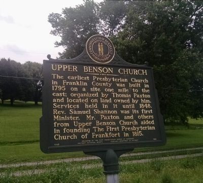
Upper Benson Church
Erected 1963 by Kentucky Historical Society, Kentucky Department of Highways. (Marker Number 595.)
Topics and series. This historical marker is listed in these topic lists: Churches & Religion • Settlements & Settlers. In addition, it is included in the Kentucky Historical Society series list. A significant historical year for this entry is 1795.
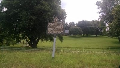
Location. 38° 6.009′ N, 84° 55.111′ W. Marker is in Frankfort, Kentucky, in Franklin County. Marker is on U.S. 127, 0.1 miles north of Keaton Lane, on the right when traveling north. Touch for map. Marker is in this post office area: Frankfort KY 40601, United States of America. Touch for directions.
Other nearby markers. At least 8 other markers are within 6 miles of this marker, measured as the crow flies. Renowned Congressman (approx. 2.8 miles away); County Named, 1827 (approx. 4˝ miles away); Distinguished Officers - Alumni of Kavanaugh / Kavanaugh School (approx. 4˝ miles away); Kavanaugh School / Mrs. "K" (approx. 4˝ miles away); Anna Mac Clarke (1919-44) (approx. 4.7 miles away); William H. Townsend (approx. 5.4 miles away); Millville Christian Church (approx. 5.8 miles away); Labrot & Graham Distillery (approx. 5.9 miles away).
Regarding Upper Benson Church. Location of the church site is on private property inaccessible by road.
Credits. This page was last revised on June 16, 2016. It was originally submitted on July 1, 2015, by Dave Knoch of Scott County, Kentucky. This page has been viewed 447 times since then and 10 times this year. Photos: 1, 2. submitted on July 1, 2015, by Dave Knoch of Scott County, Kentucky. • Bill Pfingsten was the editor who published this page.

