Lanesborough in Berkshire County, Massachusetts — The American Northeast (New England)
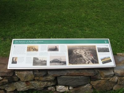
The Summit: A Peak Experience
Mount Greylock State Reservation
The Summit: A Peak Experience
Mount Greylock State Reservation
In millennia past, native peoples may have used the summit as a place of pilgrimage but left the peak in its wild, natural state. Farmers cleared the top of the mountain in the early 1800s, beginning a wave of change that continues to this day. The state established the park in 1898, and remade the peak in the 1930s, creating a recreational landscape dominated by the War Memorial Tower, Bascom Lodge and the Appalachian Trail. Today Greylock continues to attract pilgrims, some hoping to renew their connection to the natural world.
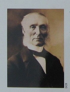
A Voice for the Mountain
After retiring as president of the University of Wisconsin in 1887, John C. Bascom (1827-1911) returned to his previous position as a professor at Williams College, located at the foot of the mountain. He became one of the first park commissioners and a powerful advocate for preservation and expanded public access.
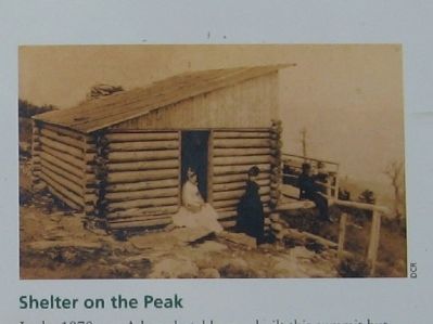
Shelter on the Peak
In the 1870s, and Adams hotel keeper built this summit hut (above, shown in 1899) to provide primitive lodging for summer hikers. The first attempt to accommodate Greylock’s visitors, the hut was indicative of the growing local interest in the mountain as a scenic resource. In 1885, Berkshire businesspeople Stephen aside 400 acres at the peak, beginning a conservation effort that continues to this day.
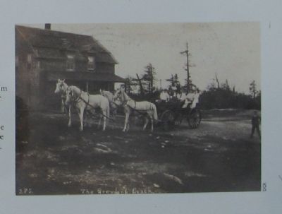
First Summit House
By 1902, the park had grown to almost ten times its initial size, and needed a truly weather-proof structure on the peak for its superintendent. This summit house (left, in a photo at right from 1908) provided a rough lodging for visitors on the second floor. But park advocates regarded it from the beginning as a crude substitute for a grander structure – one more befitting Greylock’s unique status.
“. . . Greylock, our daily pleasure, our constant symbol, our ever renewed inspiration, for all who have fellowship with Nature.” – John Bascom, “Greylock Reservation,” 1907
The Lodge takes Shape
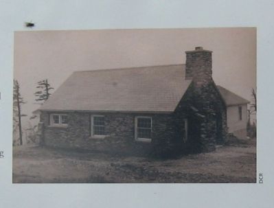
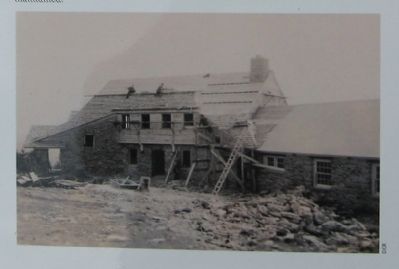
After the old summer house burned down in 1929, the state built a new stone lodge three years later. This structure was named in honor of John Bascom, wo had long desired appropriate accommodations for hikers and visitors to the summit. In the summer the lodge housed the Park Superintendent. The original stone building became the west wing of Bascom Lodge.
Restoration and Transformation
Key to the modern experience of the summit is Bascom Lodge, initially expanded and rebuilt by the federal Civilian Conservation Corps in 1933-38 (below). It includes a dining room and lounge areas on the first floor, and lodging
on the second. In the decades since its construction, the rustic style of the CCC building has been carefully maintained.
To Commemorate the Ultimate Sacrifice
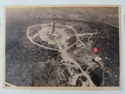
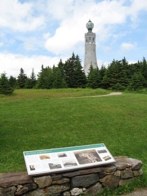
The First World War (1914-18) initiated a new and devastating age of conflict. Shocked into a new awareness of the cost of war, Massachusetts searched for a place to memorialize its losses – and eventually chose Greylock, the state’s loftiest place. Dedicated in 1933, the War Memorial Tower (right, in 1933) was intended to be an enduring, silent, yet tangible expression of love and affection from a grateful Commonwealth to the soldiers and sailors in all conflicts.
Continuing to Serve Visitors Today
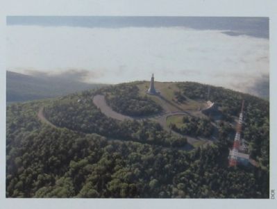
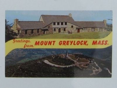
Mount Greylock State Reservation’s purpose, first articulated by John Bascom in 1907, is “simply to preserve the fine hand-work of Nature, and to give adequate access to it.” The summit in the 1990s (above) and depicted in a postcard from the 1960s (below).
Erected by Massachusetts Department of Conservation and Recreation.
Topics. This historical marker is listed in this topic list: Environment. A significant historical year for this entry is 1898.
Location. 42° 38.201′ N, 73° 10.004′ W. Marker is in Lanesborough, Massachusetts, in Berkshire County. Marker can be reached from Rockwell Road, 8.6 miles Quarry Road when traveling north. Located at the summit of Mount Greylock, tallest peak in Massachusetts. Touch for map. Marker is at or near this postal address: 30 Rockwell Road, Lanesboro MA 01237, United States of America. Touch for directions.
Other nearby markers. At least 8 other markers are within walking distance of this marker. Bascom Lodge (here, next to this marker); The Summit: An Island Above the Clouds (within shouting distance of this marker); Mount Greylock, Elevation 3,491 Feet (within shouting distance of this marker); The Mount Greylock Summit (within shouting distance of this marker); War Memorial Tower (within shouting distance of this marker); Mount Greylock, elevation 3,491 feet (within shouting distance of this marker); "A Beacon Standing for Peace" (within shouting distance of this marker); Veterans War Memorial Tower (about 300 feet away, measured in a direct line). Touch for a list and map of all markers in Lanesborough.
Also see . . .
1. Mount Greylock State Reservation. (Submitted on July 5, 2015, by Michael Herrick of Southbury, Connecticut.)
2. Mount Greylock on Wikipedia. (Submitted on July 5, 2015, by Michael Herrick of Southbury, Connecticut.)
Credits. This page was last revised on June 16, 2016. It was originally submitted on July 5, 2015, by Michael Herrick of Southbury, Connecticut. This page has been viewed 349 times since then and 5 times this year. Photos: 1, 2, 3, 4, 5, 6, 7, 8, 9, 10. submitted on July 5, 2015, by Michael Herrick of Southbury, Connecticut.
