Swine Pavilion
1922
— Architect: Thomas Bast • Contractors: Dean & Hancock —
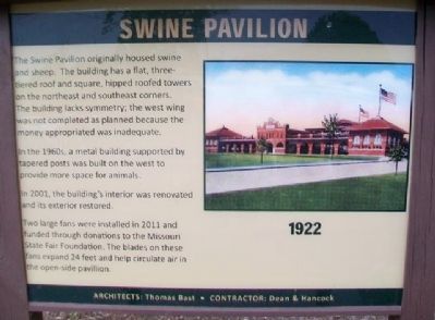
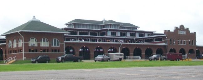
The Swine Pavilion originally housed swine and sheep. The building has a flat, three-tiered roof and square, hipped roofed towers on the northeast and southeast corners. The building lacks symmetry; the west wing was not completed as planned because the money appropriated was inadequate.
In the 1960s, a metal building supported by tapered posts was built on the west to provide more space for animals.
In 2001, the building's interior was renovated and its exterior restored.
Two large fans were installed in 2011 and funded through donations to the Missouri State Fair Foundation. The blades on these fans expand 24 feet and help circulate air in the open-sided pavillion.
Erected by Missouri State Fair Commission.
Topics. This historical marker is listed in these topic lists: Agriculture • Animals • Architecture. A significant historical year for this entry is 2001.
Location. 38° 41.561′ N, 93° 15.799′ W. Marker is in Sedalia, Missouri, in Pettis County. Marker and building are on the Missouri State Fairgrounds. Touch for map. Marker is at or near this postal address: 2503 West 16th Street, Sedalia MO 65301, United States of America. Touch for directions.
Other nearby markers. At least 8 other markers are within walking distance of this marker. Family Fun Center (approx. 0.2 miles away); Missouri Highway History (approx. ¼ mile away); Home Economics Building
Also see . . .
1. Missouri State Fairgrounds Historic District. National Register of Historic Places Registration Form (Submitted on July 5, 2015, by William Fischer, Jr. of Scranton, Pennsylvania.)
2. Missouri State Fair History. Fair website entry (Submitted on July 5, 2015, by William Fischer, Jr. of Scranton, Pennsylvania.)
Credits. This page was last revised on June 5, 2022. It was originally submitted on July 5, 2015, by William Fischer, Jr. of Scranton, Pennsylvania. This page has been viewed 273 times since then and 9 times this year. Photos: 1, 2. submitted on July 5, 2015, by William Fischer, Jr. of Scranton, Pennsylvania.

