Esther Short in Vancouver in Clark County, Washington — The American West (Northwest)
Captain George Vancouver Monument Plaza
1792 Discovery
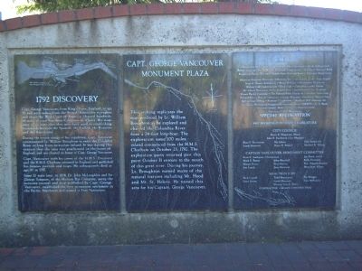
[Panel 1]:
Capt. George Vancouver, from King’s Lynn, England, at age 35 and with orders from the British Admiralty to explore and chart the West Coast of America, charted hundreds of miles of coast line from California to Alaska. His maps were so accurate that they were later used in establishing boundaries between the Spanish, the English, the Russians and the Americans.
During the return voyage of his expedition, Capt. Vancouver commissioned Lt. William Broughton to enter the Columbia River in long boats to explore inland. It was during this venture that the area was proclaimed in the name of England, and was chartered in honor of Capt. George Vancouver.
Capt. Vancouver with his crews of the H.M.S. Discovery and the H.M.S. Chatham returned to England and published his famous journals and maps. He subsequently died at age 40 in 1797.
Some 32 years later, in 1824, Dr. John McLoughlin and Sir George Simpson, of the Hudson Bay Company, using the accurate journal and map published by Capt. George Vancouver, established the first permanent settlement in the Pacific Northwest and named it Fort Vancouver.
[Panel 2]:
This etching replicates the map produced by Lt. William Broughton as he explored and charted the Columbia River from a 24-foot long boat. The exploration some 100 miles inland commenced from the H.M.S. Chatham on October 23, 1792. The exploration party returned past this point October 31 enroute to the mouth of this great river. During his journey, Lt. Broughton named many of the natural features including Mt. Hood and Mt. St. Helens. He named this area for his Captain, George Vancouver.
[Panel 3]:
Credits and Special Recognition.
[Names of private and corporate sponsors of the monument, city and state officials and monument committee members.]
Erected 1992.
Topics. This historical marker is listed in these topic lists: Exploration • Settlements & Settlers • Waterways & Vessels. A significant historical month for this entry is October 1776.
Location. 45° 37.307′ N, 122° 40.434′ W. Marker is in Vancouver, Washington, in Clark County. It is in Esther Short. Marker is on Columbia Street near 3rd Street, on the right when traveling east. Touch for map. Marker is at or near this postal address: 100 Columbia Street, Vancouver WA 98660, United States of America. Touch for directions.
Other nearby markers. At least 8 other markers are within walking distance of this marker. Captain George Vancouver Monument (here, next to this marker); United States Army Arrives (approx. 0.2 miles away); A Busy Place Is This (approx. 0.2 miles away); Heart of a Trading Empire (approx. ¼ mile away); Esther Short (approx. 0.3 miles away); A River of Settlers (approx. 0.3 miles away); The Red Cross Convalescent House (approx. half a mile away); The Artillery Barracks (approx. half a mile away). Touch for a list and map of all markers in Vancouver.

Photographed By Kevin W., June 12, 2008
5. Captain George Vancouver Monument Plaza Marker
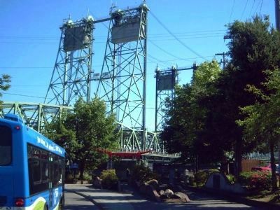
Marker is in the right foreground. Immediately behind it is the Captain George Vancouver Monument (see nearby markers for more information). In the distant background is the Interstate 5 bridge crossing the Columbia River between Vancouver, WA and Portland, OR.
Credits. This page was last revised on February 7, 2023. It was originally submitted on June 23, 2008, by Kevin W. of Stafford, Virginia. This page has been viewed 2,131 times since then and 21 times this year. Photos: 1, 2, 3, 4, 5. submitted on June 23, 2008, by Kevin W. of Stafford, Virginia.
![Captain George Vancouver Monument Plaza Marker </b>[Panel 1]. Click for full size. Captain George Vancouver Monument Plaza Marker </b>[Panel 1] image. Click for full size.](Photos/26/Photo26095.jpg?11252005)
![Captain George Vancouver Monument Plaza Marker </b>[Panel 2]. Click for full size. Captain George Vancouver Monument Plaza Marker </b>[Panel 2] image. Click for full size.](Photos/26/Photo26096.jpg?11252005)
![Captain George Vancouver Monument Plaza Marker </b>[Panel 3]. Click for full size. Captain George Vancouver Monument Plaza Marker </b>[Panel 3] image. Click for full size.](Photos/26/Photo26097.jpg?11252005)
