Penn Valley in Nevada County, California — The American West (Pacific Coastal)
Bridgeport Bridge
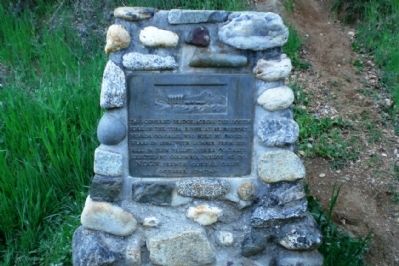
Inscription.
This covered bridge across the South Fork of the Yuba River at Bridgeport, Nevada Co., Calif. was built by David I. Wood in 1862 with lumber from his mill in Plum Valley, Sierra Co., Calif. Erected by Columbia Parlor No. 70, N.D.G.W., French Corral, Calif. October 17, 1948.
Erected 1948 by Native Daughters of the Golden West.
Topics and series. This historical marker is listed in this topic list: Bridges & Viaducts. In addition, it is included in the Covered Bridges, and the Native Sons/Daughters of the Golden West series lists. A significant historical date for this entry is October 17, 1849.
Location. 39° 17.588′ N, 121° 11.697′ W. Marker is in Penn Valley, California, in Nevada County. Marker can be reached from Pleasant Valley Road. Touch for map. Marker is in this post office area: Penn Valley CA 95946, United States of America. Touch for directions.
Other nearby markers. At least 8 other markers are within 6 miles of this marker, measured as the crow flies. A different marker also named Bridgeport Bridge (within shouting distance of this marker); Bridgeport (Nyes Crossing) Covered Bridge (about 400 feet away, measured in a direct line); Bridgeport Historic District (about 400 feet away); The First Long Distance Telephone (approx. 2 miles away); Jacob Van Blaren (approx. 3.9 miles away); Anthony House and Ranch (approx. 4.1 miles away); Rough and Ready (approx. 5.3 miles away); Fippin's Blacksmith Shop (approx. 5.3 miles away). Touch for a list and map of all markers in Penn Valley.
More about this marker. There are three markers for the bridge, this one on the north end and two others on the south end. See nearby markers for more information.
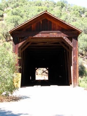
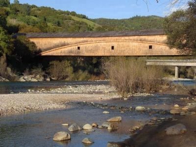
Regarding Bridgeport Bridge. Bridgeport was an important point on the Virginia Turnpike, connecting the agricultural town of Marysville in California’s Central Valley to the gold mines of Virginia City, Nevada. Miners and their supplies were carted eastwards up into the mountains, and the gold was sent back the other direction. The covered bridge had a toll until 1901, after which it was taken over by Nevada County and made free of charge. The California Department of Parks and Recreation acquired the bridge and some of the surrounding lands in 1986, incorporating them into South Yuba River State Park. The bridge was restored in 1996, damaged by flooding in 1998, and then subsequently repaired. The bridge is open to non-vehicular traffic only.
There is some question as to whether the Bridgeport covered bridge,
at a claimed length of 251 feet, is truly the longest single span covered bridge in existence, as the same claim has been put forth for the Old Blenheim Bridge in New York State. While the Bridgeport covered bridge's total length is longer, it is somewhat shorter when measuring the length it actually clears (i.e., the clear span).
Also see . . . The California Department of Parks and Recreation's webpage for South Yuba River State Park. (Submitted on June 24, 2008, by Andrew Ruppenstein of Lamorinda, California.)
Credits. This page was last revised on November 10, 2020. It was originally submitted on June 24, 2008, by Andrew Ruppenstein of Lamorinda, California. This page has been viewed 2,188 times since then and 22 times this year. Photos: 1. submitted on June 24, 2008, by Andrew Ruppenstein of Lamorinda, California. 2. submitted on June 25, 2008, by Kevin W. of Stafford, Virginia. 3, 4. submitted on June 24, 2008, by Andrew Ruppenstein of Lamorinda, California. • Kevin W. was the editor who published this page.


