Rayne in Acadia Parish, Louisiana — The American South (West South Central)
Rayne Depot Square
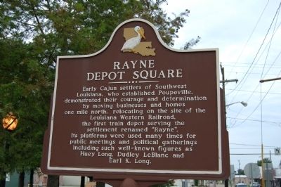
Photographed by Cajun Scrambler, July 1, 2010
1. Rayne Depot Square Marker
Topics. This historical marker is listed in these topic lists: Government & Politics • Railroads & Streetcars • Settlements & Settlers.
Location. 30° 14.127′ N, 92° 16.121′ W. Marker is in Rayne, Louisiana, in Acadia Parish. It is at the intersection of South Adams Avenue (State Highway 35) and East Texas Avenue (U.S. 90), on the right when traveling north on South Adams Avenue. Touch for map. Marker is at or near this postal address: 108 S Adams Avenue, Rayne LA 70578, United States of America. Touch for directions.

Regionally, this marker is in Louisiana’s Acadiana — Cajun Country. It is also in the American South
this page online
Other nearby markers. At least 8 other markers are within 7 miles of this marker, measured as the crow flies: Jacques Weil Company (about 300 feet away, measured in a direct line); People's Drug Store (about 400 feet away); St. Joseph's Catholic Church & Cemetery (approx. ¼ mile away); Louisiana Frog Company (approx. 0.4 miles away); Pouppeville (approx. ¾ mile away); The Bernard Bertrand Home (approx. 0.8 miles away); Crowley Louisiana Post Office 1913 (approx. 6.3 miles away); Senator John F. Kennedy Presidential Campaign Speech (approx. 6.4 miles away). Touch for a list and map of all markers in Rayne.
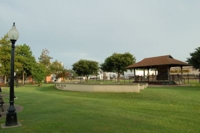
July 2, 2010
2. Rayne Depot Square
The marker is roughly in the center in this view, above the word "Square" on the low wall in the foreground.
Credits. This page was last revised on March 5, 2022. It was originally submitted on July 11, 2015. This page has been viewed 1,957 times since then and 134 times this year. Photos: 1. submitted on July 11, 2015, by Cajun Scrambler of Assumption, Louisiana. 2. submitted on July 11, 2015. • Bernard Fisher was the editor who published this page.
