Belle Mina in Limestone County, Alabama — The American South (East South Central)
Belle Mina / Woodside
Marker Front
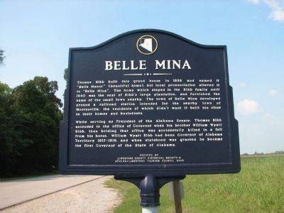
Thomas Bibb built this grand house in 1826 and named it "Belle Manor" (beautiful home), but local pronunciation altered it to "Belle Mina". The home which stayed in the Bibb family until 1940 was the seat of Bibb's large plantation and furnished the name of the small town nearby. The town of Belle Mina developed around a railroad station intended for the nearby town of Mooresville, the residents of which didn't want it built too close to their homes and business.
While serving as president of the Alabama senate, Thomas Bibb ascended to the office of Governor when his brother William Wyatt Bibb, then holding that office was accidentally killed in a fall from his horse. William Wyatt Bibb had been Governor of Alabama Territory 1817~1819 and when statehood was granted he became the first Governor of the state of Alabama.
Marker Reverse
Woodside
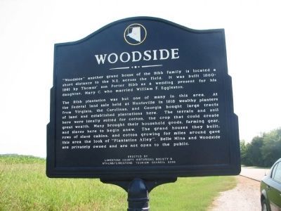
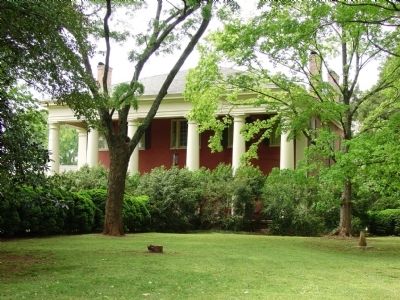
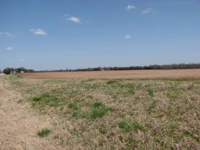
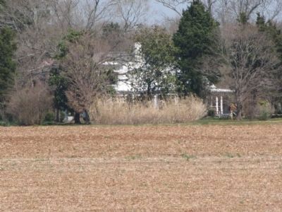
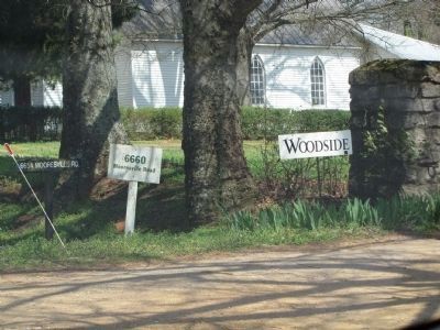
Another grand house of the Bibb family is located a short distance to the NE across the field. It was built 1860~61 by Thomas' son Porter Bibb as a wedding present for his daughter, Mary C. who married William F. Eggleston.
The Bibb plantation was but one of many in this area. At the federal land sale held at Huntsville in 1818 wealthy planters from Virginia, the Carolinas, and Georgia bought large tracts of land and established plantations here. The terrain and soil here were ideally suited for cotton, the crop that created great wealth. Many brought their household goods, farming gear, and slaves here to begin anew. The grand houses they built, rows of slave cabins and cotton growing for miles around gave this area the look of "Plantation Alley". Belle Mina and Woodside are privately owned and are not open to the public.
Erected by Limestone County Historical Society Athens/Limestone Tourism Council 2003.
Topics. This historical marker is listed in this topic list: Notable Buildings. A significant historical year for this entry is 1826.
Location. 34° 38.674′ N, 86° 52.77′ W. Marker is in Belle Mina, Alabama, in Limestone County. Marker is on Mooresville Road. Touch for map. Marker is at or near this postal address: 6185 Mooresville Rd, Belle Mina AL 35615, United States of America. Touch for directions.
Other nearby markers. At least 8 other markers are within 2 miles of this marker, measured as the crow flies. Mooresville (approx. 1.2 miles away); Cottonport / Mooresville (approx. 1.2 miles away); Mooresville, Alabama / Mooresville Stagecoach Inn and Tavern (approx. 1.2 miles away); Historic Homes of Mooresville (approx. 1.2 miles away); Mooresville Alabama (approx. 1.2 miles away); Mooresville Brick Church/The Cumberland Presbyterian Church (approx. 1.2 miles away); Historic Mooresville (approx. 1.2 miles away); Historic Buildings in Mooresville (approx. 1.3 miles away).
Also see . . .
1. Woodside Photo from Alabama. (Submitted on March 6, 2010, by Sandra Hughes Tidwell of Killen, Alabama, USA.)
2. Historic home Woodside destroyed by fire. (Submitted on December 21, 2022, by Lee Hattabaugh of Capshaw, Alabama.)
3. Historic home Woodside destroyed by fire. (Submitted on December 21, 2022, by Lee Hattabaugh of Capshaw, Alabama.)
Credits. This page was last revised on December 21, 2022. It was originally submitted on March 4, 2010, by Sandra Hughes Tidwell of Killen, Alabama, USA. This page has been viewed 5,290 times since then and 201 times this year. Last updated on July 13, 2015, by J. Makali Bruton of Accra, Ghana. Photos: 1. submitted on March 4, 2010, by Sandra Hughes Tidwell of Killen, Alabama, USA. 2. submitted on March 6, 2010, by Bill Pfingsten of Bel Air, Maryland. 3. submitted on March 29, 2010, by Lee Hattabaugh of Capshaw, Alabama. 4. submitted on March 5, 2010, by Bill Pfingsten of Bel Air, Maryland. 5, 6, 7. submitted on March 29, 2010, by Lee Hattabaugh of Capshaw, Alabama. • Bernard Fisher was the editor who published this page.
