Socastee in Horry County, South Carolina — The American South (South Atlantic)
Socastee
Photographed by J. J. Prats, February 8, 2007
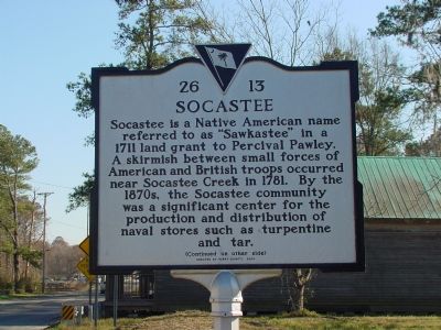
1. Socastee Marker, Side 1
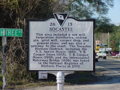
This area included a saw mill, turpentine distilleries, cotton gin, grist mill, cooper shop, and general store, and was also a gateway to the coast. The Socastee Historic District, including the S.S. Sarvis House (1881), T.B. Cooper Store (1905), and the Intracoastal Waterway Bridge (1836), was listed in the National Register of Historic Places in 2002.
Erected 2004 by Horry County. (Marker Number 26-13.)
Topics. This historical marker is listed in these topic lists: Industry & Commerce • Political Subdivisions • War, US Revolutionary. A significant historical year for this entry is 1711.
Location. 33° 41.333′ N, 79° 0.35′ W. Marker is in Socastee, South Carolina, in Horry County. It is at the intersection of Dick Pond Road (former Highway 544) and Peachtree
this page online

Regionally, this marker is on South Carolina’s Grand Strand and in the Pee Dee. It is also in the American South, specifically in the Deep South, and on the Eastern Seaboard. Globally, it is in the North Atlantic Region, North America, the Western Hemisphere, the Western World, and the Anglosphere. Historically, it finds itself in what was once the territory of the Mississippian Culture, one of the original Thirteen Colonies, one of the Confederate States of America, and the Antebellum South.
Other nearby markers. At least 5 other markers are within 4 miles of this marker, measured as the crow flies: The Sarvis House (within shouting distance of this marker); Intra-Coastal Waterway (about 400 feet away, measured in a direct line); Socastee Methodist Church (approx. 0.4 miles away); Command Chief Master Sergeant William D. Forbus (approx. 3.7 miles away); The Holocaust (approx. 3.9 miles away). Touch for a list and map
Photographed by J. J. Prats, February 8, 2007
2. Socastee Marker, Side 2
Photographed by J. J. Prats, February 8, 2007
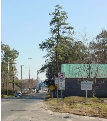
3. Socastee Marker
The building that housed the T.B. Cooper general store is behind the marker, and the Intracoastal Waterway swing bridge can be seen in the distance.
Photographed by J. J. Prats, February 8, 2007
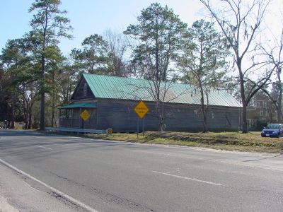
4. T. B. Cooper General Store Building
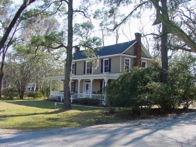
Photographed by J. J. Prats, February 8, 2007
5. The Cooper House
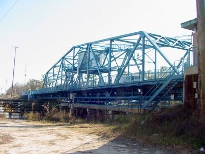
Photographed by J. J. Prats, February 8, 2007
6. The Intracoastal Waterway Metal Swing Bridge
Credits. This page was last revised on September 18, 2017. It was originally submitted on February 9, 2007, by J. J. Prats of Powell, Ohio. This page has been viewed 3,384 times since then and 58 times this year. Photos: 1, 2, 3, 4, 5, 6. submitted on February 9, 2007, by J. J. Prats of Powell, Ohio.
Editor’s want-list for this marker. Photo of the Sarvis House and pecan grove • Can you help?
