Slatington in Lehigh County, Pennsylvania — The American Northeast (Mid-Atlantic)
Lehigh Valley Railroad Station
1862 -1969
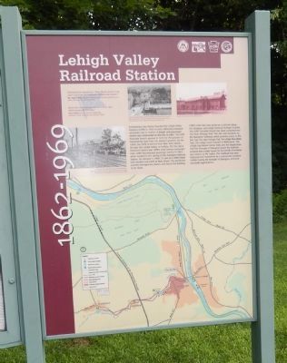
Photographed by Don Morfe, July 6, 2015
1. Lehigh Valley Railroad Station Marker
LVRR’s main line now serves as a rail trail along the Delaware and Lehigh National Heritage Corridor. The LVRR Slatedale Branch has been converted into the State Heritage Trail. This site now functions as the Slatington Trailhead, which provides access to the D & L Trail, The State Heritage Trail, The Lehigh River Water Trail, The Lehigh Canal Towpath in Walnutport, The Lehigh Gap Nature Center Trails and the Appalachian Trail. The Borough of Slatington leases the trailhead property from Lehigh County for the benefit of residents and
this page online
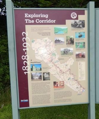
Adjacent "Exploring the Corridor" informational sign:
“Our residents take pride and partner in their heritage---they understand the meaning of what we have an act to preserve it” Delaware & Lehigh National Heritage Corridor and State Heritage Park, Management Action Plan.
Welcome to the Delaware & Lehigh National and State Heritage Corridor, a collection of people, places and events that helped shape our great nation. Come journey through five Pennsylvania counties bursting with heritage and brimming with outdoor adventure. Canals and railroads---remnants of Northeastern Pennsylvania prosperous coal age---form the spine of this more than 150-mile Corridor. You’ll find something for everyone. Follow a history trail marked with stories about hearty lumberjacks, coal miners, lock tenders, canalers and railroads. Explore quiet canal paths, challenging bike trails and rippling waters of the Delaware and Lehigh Rivers.
In the Corridor’s northern reach experience life within Luzerne County coal towns and vibrant cities proudly displaying ethnic diversity. Spend time in our arts and educational
Photographed by Don Morfe, July 6, 2015
2. Adjacent "Exploring the Corridor" Informational sign
Discover Moravian heritage within the valley's oldest city, learn about the steel and cement industries, or attend some of America's best festivals. The excitement continues as you travel south along the Delaware River Scenic Drive into Bucks County. This area offers pastoral vistas, landmarks from America's battle for independence and a renowned artist's community intermingled with Colonial farmsteads.
Relive history and discover a distinctive American landscape within the Corridor. We invite you to bask in our heritage, ride or walk our trails, and enjoy our waterways.
Erected by Delaware and Lehigh National Heritage Corridor.
Topics and series. This historical marker is listed in these topic lists: Industry & Commerce • Railroads & Streetcars. In addition, it is included in the Lehigh Canal series list. A significant historical month for this entry is February 1832.
Location. 40° 45.15′ N, 75° 36.27′ W. Marker
Photographed by Don Morfe, July 6, 2015
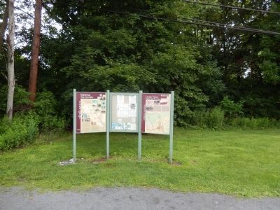
3. Lehigh Valley Railroad Station Marker

Regionally, this marker is in Southeast Pennsylvania and in Lehigh Valley. It is also in the American Northeast and in the Mid-Atlantic. Globally, it is in North America, the Western Hemisphere, the Western World, and the Anglosphere. Historically, it finds itself in what was once the Haudenosaunee (Iroquois) Confederacy and also one of the original Thirteen Colonies.
Other nearby markers. At least 8 other markers are within walking distance of this marker: Slate Industry (within shouting distance of this marker); Kern Settlers (within shouting distance of this marker); Lehigh River (approx. 0.2 miles away); Floating From Mine to Market (approx. 0.2 miles away); Lehigh Canal (approx. 0.2 miles away); Warrior’s Path (approx. 0.2 miles away); First School Slate Factory (approx. 0.2 miles away); Anchor Hotel (approx. 0.2 miles away). Touch for a list and map of all markers in Slatington.
Photographed by Don Morfe, July 6, 2015
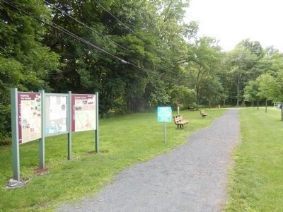
4. Lehigh Valley Railroad Station Marker
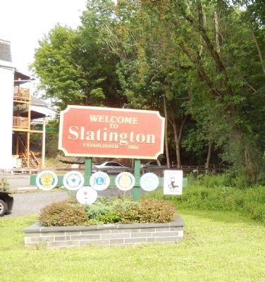
Photographed by Don Morfe, July 6, 2015
5. Welcome to Slatington established 1864
Credits. This page was last revised on June 16, 2016. It was originally submitted on July 18, 2015, by Don Morfe of Baltimore, Maryland. This page has been viewed 1,389 times since then and 75 times this year. Photos: 1, 2, 3, 4, 5. submitted on July 18, 2015, by Don Morfe of Baltimore, Maryland. • Bill Pfingsten was the editor who published this page.
