Near Nevada City in Nevada County, California — The American West (Pacific Coastal)
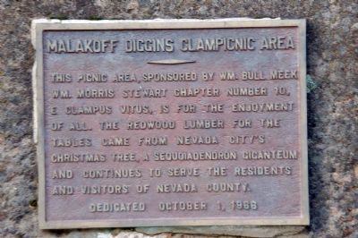
Malakoff Diggins Clampicnic Area
Dedicated October 1, 1966
Erected 1966.
Topics and series. This historical marker is listed in these topic lists: Charity & Public Work • Fraternal or Sororal Organizations • Parks & Recreational Areas. In addition, it is included in the Chinese Heritage Sites of the American West, and the E Clampus Vitus series lists. A significant historical date for this entry is October 1, 1711.
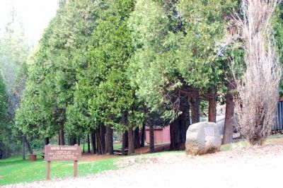
Location. 39° 22.061′ N, 120° 54.031′ W. Marker is near Nevada City, California, in Nevada County. Marker is at the intersection of North Bloomfield Road and Relief Hill Road, on the left when traveling east on North Bloomfield Road. It is at the Malakoff Diggins State Historic Park. Touch for map. Marker is in this post office area: Nevada City CA 95959, United States of America. Touch for directions.
Other nearby markers. At least 5 other markers are within walking distance of this marker. Giant (within shouting distance of this marker); St. Columncille's Church (approx. ¼ mile away); North Bloomfield School (approx. ¼ mile away); Shoot (Chute) Hill (approx. half a mile away); Alvin Stevens Trivelpiece (approx. 0.6 miles away).
Also see . . .
1. Malakoff Diggins State Historic Park. (Submitted on February 9, 2007, by Karen Key of Sacramento, California.)
2. A Non-Clamper's Guide to Clamperdom. by Judge Frazier, Noble Grand Humbug, Lucinda Jane Saunders chapter. (Submitted on February 9, 2007.)
Credits. This page was last revised on October 21, 2020. It was originally submitted on February 9, 2007, by Karen Key of Sacramento, California. This page has been viewed 2,937 times since then and 61 times this year. Photos: 1, 2, 3. submitted on February 9, 2007, by Karen Key of Sacramento, California. • J. J. Prats was the editor who published this page.


