Branxton in Northumberland, England, United Kingdom — Northwestern Europe (the British Isles)
After the Battle of Flodden
Branxton Church
Photographed by Brandon Fletcher, June 3, 2013
1. Branxton Church Marker
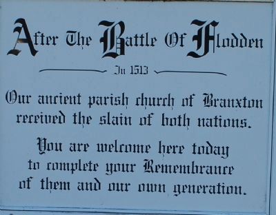
After the Battle of Flodden
----------In 1513--------
Our ancient parish church of Branxton
received the slain of both nations.
You are welcome here today
to complete your Remembrance
of them and our own generation.
Topics. This historical marker is listed in this topic list: Religion & Religious Structures.
Location. 55° 37.855′ N, 2° 10.377′ W. Marker is in Branxton, England, in Northumberland. It is on unnamed street. Touch for map. Touch for directions.

Regionally, this marker is in North East England. It is also in British Border Reivers Country. Globally, it is on the Atlantic Ocean, in the North Atlantic Region, in Europe, in Atlantic Europe, on one of the British Isles, in the Western World, and in the Anglosphere. Historically, it finds itself in what was once the Roman Empire.
Other nearby markers. At least one other marker is within walking distance of this marker: Flodden (approx. 0.3 kilometers away).
Related markers. Click here for a list of markers that are related to this marker. To better understand the relationship, study each
this page online
Also see . . . Remembering Flodden. Interactive website that allows you to move around the battlefield (Submitted on July 24, 2015, by Brandon Fletcher of Chattanooga, Tennessee.)
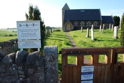
Photographed by Brandon Fletcher, June 3, 2013
2. Branxton Church Marker

Photographed by Brandon Fletcher, June 3, 2013
3. Branxton Church Marker
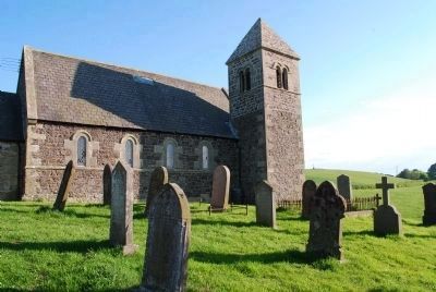
Photographed by Brandon Fletcher, June 3, 2013
4. Branxton Church
Flodden Monument can be seen in the distant to the right of the church.
Credits. This page was last revised on June 22, 2026. It was originally submitted on July 20, 2015, by Brandon Fletcher of Chattanooga, Tennessee. This page has been viewed 418 times since then and 44 times this year. Photos: 1, 2, 3, 4. submitted on July 20, 2015, by Brandon Fletcher of Chattanooga, Tennessee. • Andrew Ruppenstein was the editor who published this page.
