Dalton in Whitfield County, Georgia — The American South (South Atlantic)
Crow Valley
"...too strong to be carried without great slaughter."
| — | Atlanta Campaign Heritage Trail | — |
Photographed by Brandon Fletcher, February 21, 2012
1. Crow Valley Marker
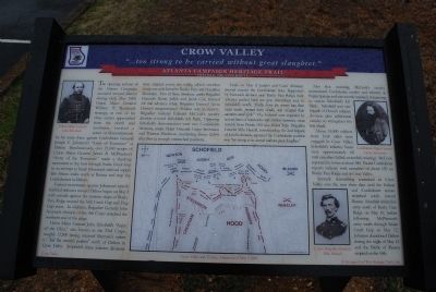
Federal movements against Johnston's heavily fortified defenses around Dalton began on May 8 with assaults against the western slope of Rocky Face Ridge around Mill Creek Gap and Dug Gap areas. In addition, Brigadier General John Newton's division of the th Corps attacked the northern edge of the ridge.
Union Major General John Scholfield's "Army of the Ohio," also known as the 23rd Corps, roughly 13,500 strong, received Sherman's orders to "feel the enemy's position" north of Dalton in Crow Valley. Scholfield's
this page online
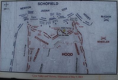
Early on May 9, Judah's and Cox's divisions moved toward the Confederate lines. Supported by Newton's division atop Rocky Face Ridge, their advance pushed back the gray skirmishers and, in Schofield's words, "finally drove the enemy into their main works, pressed them closely, and occupied their attention until dark." The Federals were impeded by several lines of barricades and artillery batteries, most notably from Potato Hill (aka Picket Top). Brigadier General Milo Hascall, commanding the 2nd brigade of Judah's division, reported the Confederate position was "too strong to be carried without great slaughter."
Also
Photographed by Brandon Fletcher, February 21, 2012
2. Crow Valley Marker
About 15,000 soldiers from both sides were engaged in Crow Valley. Schofield's infantry losses were approximately 60 total casualties (killed, wounded, missing). McCook reported his losses at about 140. Partial Confederate reports indicate total casualties of about 130 on Rocky Face Ridge and in Crow Valley.
Sporadic skirmishing continued in Crow Valley over the next three days until the Federal and Confederate armies marched south toward Resaca. Schofield shifted his army north of Rocky Face Ridge on May 10, before following McPherson's army south through Snake Creek Gap on May 12. Johnston abandoned Dalton during the night of May 12 and the Battle of Resaca erupted on the 14th.
Erected by Georgia Civil War Heritage Trails.
Topics and series. This historical marker is listed in this topic list: War, US Civil. In addition, it is included in the
Photographed by Brandon Fletcher, February 21, 2012
3. Crow Valley and Vicinity, Afternoon of May 9, 1864
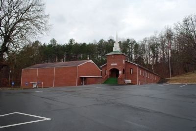
Location. 34° 50.101′ N, 84° 59.233′ W. Marker is in Dalton, Georgia, in Whitfield County. It can be reached from the intersection of Poplar Springs Road NW and Kittle Road NW, on the right when traveling east. Located east of the parking lot at Poplar Springs Baptist Church. Touch for map. Marker is in this post office area: Dalton GA 30720, United States of America. Touch for directions.

Regionally, this marker is in Georgia’s Mountains. It is also in the American South, specifically in the Deep South, in Appalachia, and specifically in Southern Appalachia. Globally, it is in North America, the Western Hemisphere, the Western World, and the Anglosphere. Historically, it finds itself in what was once the original Cherokee Nation, the territory of the Mississippian Culture, one of the original Thirteen Colonies, one of the Confederate States of America, and the Antebellum South.
Other nearby markers. At least 8 other markers are within 3 miles of this marker, measured as the crow flies: North Line Dalton’s Defenses (about 700 feet
Photographed by Brandon Fletcher, February 21, 2012
4. Crow Valley Marker
Photographed by Brandon Fletcher, February 21, 2012
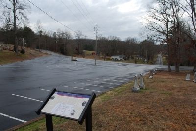
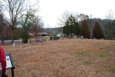
5. Potato Hill (Picket Top) can be seen in the distance to the right.
Photographed by Brandon Fletcher, February 21, 2012
6. Poplar Springs Baptist Church
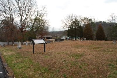
Marker is located in the church cemetery.
Credits. This page was last revised on November 16, 2017. It was originally submitted on July 22, 2015, by Brandon Fletcher of Chattanooga, Tennessee. This page has been viewed 1,550 times since then and 104 times this year. Photos: 1, 2, 3, 4, 5, 6. submitted on July 22, 2015, by Brandon Fletcher of Chattanooga, Tennessee. • Bernard Fisher was the editor who published this page.
