Springfield in Livingston Parish, Louisiana — The American South (West South Central)
Springfield's Role in West Florida Revolution
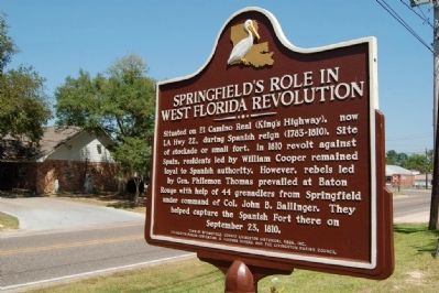
Photographed by Cajun Scrambler, May 6, 2011
1. Springfield's Role in West Florida Revolution Marker
Erected by Town of Springfield, Edward Livingston Historical Assn., Inc., Livingston Parish Convention and Visitors Bureau and Livingston Parish Council.
Topics. This historical marker is listed in these topic lists: Forts and Castles • Military • Settlements & Settlers. A significant historical month for this entry is September 1850.
Location. 30° 25.773′ N, 90° 32.983′ W. Marker is in Springfield, Louisiana, in Livingston Parish. It is at the intersection of Main Street (State Highway 42) and Elizabeth Coxe Street, on the left on Main Street. Touch for map. Marker is in this post office area: Springfield LA 70462, United States of America. Touch for directions.

Regionally, this
this page online
Other nearby markers. At least 8 other markers are within 7 miles of this marker, measured as the crow flies: Springfield (within shouting distance of this marker); Springfield Cemetery Cannon (about 700 feet away, measured in a direct line); Haynes Settlement (approx. 1.4 miles away); Carter Plantation (approx. 1.7 miles away); Hungarian Settlement (approx. 3.9 miles away); Albany, Louisiana (approx. 5.3 miles away); PFC Raymond "Mike" Clausen, Jr. (approx. 5.6 miles away); Ponchatoula Depot (approx. 6½ miles away). Touch for a list and map of all markers in Springfield.
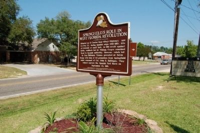
Photographed by Cajun Scrambler, May 6, 2011
2. Springfield's Role in West Florida Revolution Marker
Credits. This page was last revised on May 28, 2023. It was originally submitted on July 24, 2015. This page has been viewed 1,105 times since then and 78 times this year. Photos: 1, 2. submitted on July 24, 2015. • Bernard Fisher was the editor who published this page.
