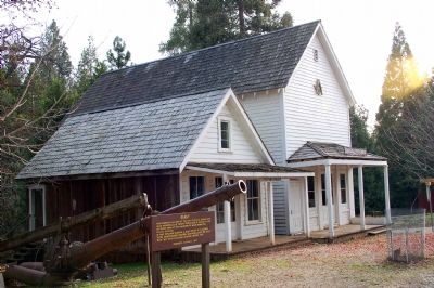
Near Nevada City in Nevada County, California — The American West (Pacific Coastal)
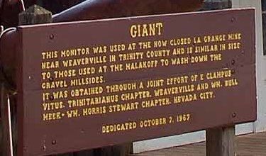
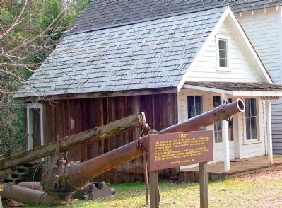
Giant
It was obtained through a joint effort of E Clampus Vitus, Trinitarianus Chapter, Weaverville, and Wm. Bull Meek-Wm. Morris Stewart Chapter, Nevada City.
Erected 1967 by E Clampus Vitus Wm. Bull Meek-Wm. Morris Stewart Chapter.
Topics and series. This historical marker is listed in these topic lists: Industry & Commerce • Natural Resources. In addition, it is included in the E Clampus Vitus series list.
Location. 39° 22.08′ N, 120° 53.988′ W. Marker is near Nevada City, California, in Nevada County. Marker is at the intersection of North Bloomfield Road and Relief Hill Road, on the right when traveling east on North Bloomfield Road. Touch for map. Marker is in this post office area: Nevada City CA 95959, United States of America. Touch for directions.
Other nearby markers. At least 5 other markers are within walking distance of this marker. Malakoff Diggins Clampicnic Area (within shouting distance of this marker); St. Columncille's Church (approx. ¼ mile away); North Bloomfield School (approx. 0.3 miles away); Shoot (Chute) Hill (approx. half a mile away); Alvin Stevens Trivelpiece (approx. 0.6 miles away).
Regarding Giant. A monitor is a high-pressure water cannon used in what was known as hydraulic mining for gold. After the mountainside was blasted open, these monitors washed the gravel down to sluice boxes that separated gold from gravel.
Also see . . . Hydraulic Gold Mining. Gold Rush Nuggets entry. (Submitted on September 23, 2020, by Larry Gertner of New York, New York.)
Credits. This page was last revised on September 23, 2020. It was originally submitted on February 9, 2007, by Karen Key of Sacramento, California. This page has been viewed 2,276 times since then and 12 times this year. Last updated on February 12, 2007, by Karen Key of Sacramento, California. Photos: 1, 2, 3, 4, 5. submitted on February 9, 2007, by Karen Key of Sacramento, California. • J. J. Prats was the editor who published this page.
