Woolen Mills near Charlottesville, Virginia — The American South (Mid-Atlantic)
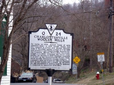
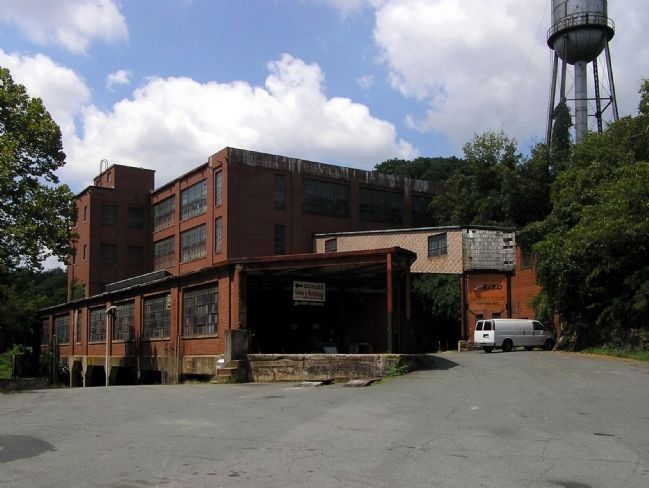
Charlottesville Woolen Mills
Erected 2000 by Department of Historic Resources. (Marker Number Q-24.)
Topics and series. This historical marker is listed in this topic list: Industry & Commerce. In addition, it is included in the Virginia Department of Historic Resources (DHR) series list. A significant historical year for this entry is 1795.
Location. 38° 1.317′ N, 78° 27.396′ W. Marker is near Charlottesville, Virginia. It is in Woolen Mills. Marker is on East Market Street just west of Riverside Avenue, on the left when traveling east. Touch for map. Marker is in this post office area: Charlottesville VA 22902, United States of America. Touch for directions.
Other nearby markers. At least 8 other markers are within walking distance of this marker. Woolen Mills Village Historic District (approx. 0.2 miles away); Riverview Park (approx. 0.2 miles away); The Woolen Mills (approx. 0.2 miles away); a different marker also named The Woolen Mills (approx. 0.2 miles away); a different marker also named The Woolen Mills (approx. 0.2 miles away); North Terrace Wing (approx. 0.8 miles away); Barrier (approx. 0.8 miles away); Ice House (approx. 0.8 miles away). Touch for a list and map of all markers in Charlottesville.
Also see . . .
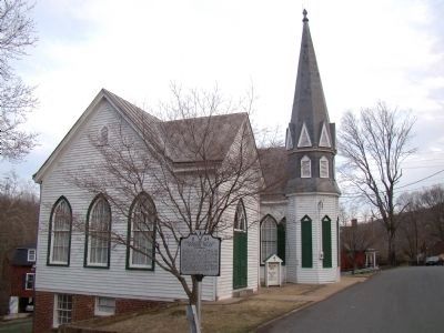
1. Charlottesville Woolen Mills Chronology. Compiled by O. Allan Gianniny, Jr. “1887- Employees approached Marchant for money to help build a chapel. The mill gave $150 and bought a plot of land. Construction started in July, and by Christmas a Gothic style church, 20 feet by 40 feet had been erected. A Christmas program was held in the new building.” (Submitted on April 16, 2009.)
2. The Charlottesville Woolen Mills: Working Life, Wartime, and the Walkout of 1918. by Andrew H. Myers. “On this morning, the company experienced its first labor disturbance since opening in 1867. Eighteen workers walked out of the plant after the general manager refused
to compensate them for wages lost during a shutdown. This number comprised a relatively small percentage of the 130 or so employees, but the loss of skilled, experienced, hands struck a serious blow to management. Moreover, given the closely-interwoven nature of the Woolen Mills community, the unrest had great potential to spread. News of the incident made the front page of the local Daily Progress. So, too, did an advertisement for replacements.” (Submitted on April 16, 2009.)
Credits. This page was last revised on February 2, 2023. It was originally submitted on April 16, 2009, by J. J. Prats of Powell, Ohio. This page has been viewed 2,849 times since then and 62 times this year. Last updated on February 10, 2021, by Carl Gordon Moore Jr. of North East, Maryland. Photos: 1, 2. submitted on April 16, 2009, by J. J. Prats of Powell, Ohio. 3. submitted on August 15, 2009, by PaulwC3 of Northern, Virginia. • J. Makali Bruton was the editor who published this page.


