Sackets Harbor in Jefferson County, New York — The American Northeast (Mid-Atlantic)
Carrying Cable Route
Photographed by Dale K. Benington, July 22, 2015
1. Carrying Cable Route Marker
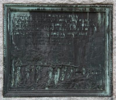
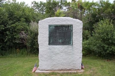
Route traveled by the men who carried the four-ton cable for the ship "Superior" twenty miles from Sandy Creek Battlefield to Sackets Harbor in June 1814.
Erected 1930 by New York State Society N.S.U.S., Daughters of 1812, and the State of New York.
Topics and series. This historical marker is listed in this topic list: War of 1812. In addition, it is included in the United States Daughters of 1812, National Society series list. A significant historical month for this entry is June 1814.
Location. 43° 55.666′ N, 76° 6.492′ W. Marker is in Sackets Harbor, New York, in Jefferson County. It is on Smithville Road (County Route 75) north of New York State Route 3, on the right when traveling north. Located 100 feet off the road, facing County Road 75, in a clearing behind commercial property on the northeast corner. Touch for map. Marker is in this post office area: Sackets Harbor NY 13685, United States of America. Touch for directions.

Regionally, this marker is in Upstate New York and in the Adirondacks & North Country. It is also in the American Northeast and in the Mid-Atlantic. Globally, it is in North America, on
this page online
Other nearby markers. At least 8 other markers are within 2 miles of this marker, measured as the crow flies: Blockhouse (approx. 1.4 miles away); Fort Chauncey (approx. 1.4 miles away); Fort Virginia (approx. 1.4 miles away); Battle of York Memorial (approx. 1.4 miles away); War of 1812 Unknown Soldiers Memorial (approx. 1.4 miles away); Soldiers Memorial (approx. 1½ miles away); Sackets Harbor - Fall 1814 (approx. 1½ miles away); Sackets Harbor Military Cemetery Memorial (approx. 1½ miles away). Touch for a list and map of all markers in Sackets Harbor.
More about this marker. There are three identical markers. Each marker is far from the road and easy to miss.
This marker is no longer located behind Pennocks Ice Cream (as stated in the Jefferson County website). It seems Pennocks Ice Cream relocated to the other side of State Route 3, because today

Photographed by Dale K. Benington, July 22, 2015
2. Route Map
Close-up view of the marker.
Regarding Carrying Cable Route. According to a Jefferson County website, there are several markers that commemorate "the Battle of Big Sandy" and/or the "Carrying of the Cable." The website indicates, "There are a number of monuments for the battle as well as the carrying of the Great Cable, as it came to be known. One is right outside Sackets Harbor behind Pennocks Ice Cream Store, another is between Ellisburg and Belleville on Route 289 at the intersection of Lee/Machold Roads, and another in Smithville. These memorials consist of a large piece of granite weighing six tons, seven and a half feet tall and six feet wide, with a plaque. There is also a monument at the site of battle - a large boulder with an inscription, and a marker a short distance away at the McKee Hospital site."
Related markers. Click here for a list of markers that are related to this marker. To better understand the relationship, study each marker in the order shown.
Also see . . .
1. War of 1812: The Carry of the Great Rope.
Photographed by Dale K. Benington, July 22, 2015
3. Carrying Cable Route Marker
2. U.S.S. Superior (1814). Wikipedia entry (Submitted on May 9, 2024, by Larry Gertner of New York, New York.)

Photographed by Dale K. Benington, July 22, 2015
4. Carrying Cable Route Marker
The marker is in the back yard of a commercial building.

Photographed by Dale K. Benington, July 22, 2015
5. Carrying Cable Route Marker
The red roof of Pennocks Ice Cream store at right.
Credits. This page was last revised on May 10, 2024. It was originally submitted on July 26, 2015, by Dale K. Benington of Toledo, Ohio. This page has been viewed 1,093 times since then and 55 times this year. Photos: 1, 2, 3, 4, 5. submitted on July 26, 2015, by Dale K. Benington of Toledo, Ohio.
