Richmond in Madison County, Kentucky — The American South (East South Central)
"The Loud Mouthed Dogs of War Were Unleashed"
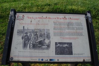
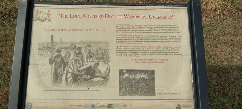
The Battle of Richmond Began At An Artillery Duel
Inscription.
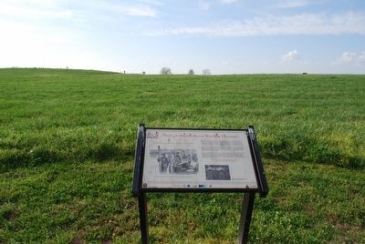
The Battle of Richmond began about 5 AM on August 30, 1862, as pickets from Gen. Mahlon Manson's Union brigade and Gen. Patrick Cleburne's Confederate division exchanged shots. With the initial rattle of musketry both side began shaping their lines, Lt. Edwin O. Lanphere's artillery opened fire at the column of Confederate infantry and artillery marching up the Old State Road. In response, Cleburne placed Douglas' 1st Texas Battery on a hill just north of the Crooksville road and ordered it to return fire. By 8 AM the artillery duel had begun.
Cleburne had two artillery batteries, Marion's Florida Artillery and Douglas' 1st Texas Artillery, a total of eight guns. He used his artillery skillfully, first deploying the Texans north of Crooksville Road and moving them forward as needed. After the Texans were in place he ordered Marion's Florida Light Artillery forward. After initially deploying too far north, the Floridians settled in and began to bombard the Union line in earnest, while the rest of the Confederate infantry was brought forward.
By 8 AM Cleburne had ordered his artillery to "fire slowly and not waste a single round." At this point Cleburne was using his artillery to keep the Union forces occupied while Gen. Thomas J. Churchill advanced his division north through the ravine from which he could hit the exposed Union right. The slow and deliberate fire of the Confederate artillery proved effective, but also costly. Over the course of the morning both batteries lost officers and men killed and wounded and at one point volunteers from a nearby infantry regiment were required to come forward to man the guns.
The Confederate gunners fired for two hours before the infantry was able to break the Union line.
Topics. This historical marker is listed in this topic list: War, US Civil. A significant historical year for this entry is 1862.
Location. 37° 39.945′ N, 84° 15.033′ W. Marker is in Richmond, Kentucky, in Madison County. Marker can be reached from the intersection of Battlefield Memorial Highway (U.S. 421) and Hays Fork Lane, on the right when traveling south. Touch for map. Marker is at or near this postal address: 101 Battlefield Memorial Hwy, Richmond KY 40475, United States of America. Touch for directions.
Other nearby markers. At least 8 other markers are within walking distance of this marker. Sharpshooters Check The Union Right (within shouting distance of this marker); A Near Fatal Mistake (within shouting distance of this marker); The Union Trail (about 400 feet away, measured in a direct line); Manson's Mistake (about 400 feet away); Barnett Burial Ground (about 500 feet away); A Reckless And Useless Charge (about 500 feet away); Saving the Richmond Battlefield
(about 600 feet away); In Honor and Remembrance (about 600 feet away). Touch for a list and map of all markers in Richmond.
Credits. This page was last revised on December 2, 2022. It was originally submitted on July 26, 2015, by Brandon Fletcher of Chattanooga, Tennessee. This page has been viewed 547 times since then and 49 times this year. Last updated on February 21, 2021, by Bradley Owen of Morgantown, West Virginia. Photos: 1. submitted on July 26, 2015, by Brandon Fletcher of Chattanooga, Tennessee. 2. submitted on November 15, 2022, by Craig Doda of Napoleon, Ohio. 3, 4. submitted on July 26, 2015, by Brandon Fletcher of Chattanooga, Tennessee. • J. Makali Bruton was the editor who published this page.


