
Birmingham in Oakland County, Michigan — The American Midwest (Great Lakes)
Field Building
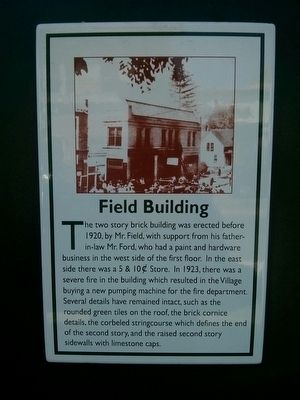
Photographed by Joel Seewald, July 26, 2015
1. Field Building Marker
Topics. This historical marker is listed in this topic list: Notable Buildings. A significant historical year for this entry is 1920.
Location. 42° 32.796′ N, 83° 12.928′ W. Marker is in Birmingham, Michigan, in Oakland County. It is on West Maple Road 0.1 miles west of Old Woodward Avenue, on the left when traveling west. Touch for map. Marker is at or near this postal address: 137 & 141 West Maple Road, Birmingham MI 48009, United States of America. Touch for directions.

Regionally, this marker is in Southeast Michigan and in Greater Detroit. It is also in the American
this page online
Other nearby markers. At least 8 other markers are within walking distance of this marker: The Quarton Building (a few steps from this marker); Billy McBride Building (within shouting distance of this marker); The Erity-Nixon Building (within shouting distance of this marker); Ford Building (within shouting distance of this marker); Bell Building (within shouting distance of this marker); City Hall (about 300 feet away, measured in a direct line); Huston Building (about 300 feet away); Johnston-Shaw Building (about 300 feet away). Touch for a list and map of all markers in Birmingham.
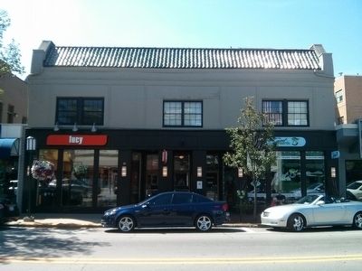
Photographed by Joel Seewald, July 26, 2015
2. Field Building
Credits. This page was last revised on July 5, 2022. It was originally submitted on July 27, 2015, by Joel Seewald of Madison Heights, Michigan. This page has been viewed 595 times since then and 43 times this year. Photos: 1, 2. submitted on July 27, 2015, by Joel Seewald of Madison Heights, Michigan. • Andrew Ruppenstein was the editor who published this page.
