Plumstead Township near Doylestown in Bucks County, Pennsylvania — The American Northeast (Mid-Atlantic)
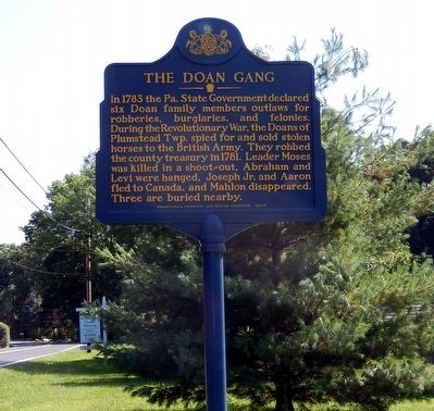
The Doan Gang
Erected 2005 by Pennsylvania Historical & Museum Commission.
Topics and series. This historical marker is listed in this topic list: War, US Revolutionary. In addition, it is included in the Pennsylvania Historical and Museum Commission series list. A significant historical year for this entry is 1783.
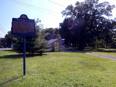
Location. 40° 22.046′ N, 75° 6.881′ W. Marker is near Doylestown, Pennsylvania, in Bucks County. It is in Plumstead Township. Marker is on Point Pleasant Pike. The marker is on the grounds of Friends Meeting House. Touch for map. Marker is at or near this postal address: 4914 Point Pleasant Pike, Doylestown PA 18902, United States of America. Touch for directions.
Other nearby markers. At least 8 other markers are within 3 miles of this marker, measured as the crow flies. Army (approx. 1.9 miles away); Marines (approx. 1.9 miles away); Navy (approx. 2 miles away); Air Force (approx. 2 miles away); The Plumstead Township Veterans Park (approx. 2 miles away); Coast Guard (approx. 2 miles away); Aaron Siskind (approx. 2.9 miles away); James Emory "Jimmie" Foxx (approx. 3 miles away). Touch for a list and map of all markers in Doylestown.
Credits. This page was last revised on February 7, 2023. It was originally submitted on July 27, 2015, by Don Morfe of Baltimore, Maryland. This page has been viewed 1,171 times since then and 70 times this year. Photos: 1, 2. submitted on July 27, 2015, by Don Morfe of Baltimore, Maryland. • Bill Pfingsten was the editor who published this page.

