Odessa in Ector County, Texas — The American South (West South Central)
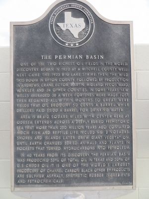
The Permian Basin
Photographed by Bill Kirchner, July 11, 2015
1. The Permian Basin Marker
Area is 88,610 square miles, with center here at Odessa. Extends across a deeply buried prehistoric sea that more than 250 million years ago contained much fish and reptile life, including dinosaurs. Shores and islands later grew giant vegetation, until earth changes buried animals and plants in pockets that turned hydrocarbons into petroleum.
In 40 years from its discovery, the Permian Basin, was producing 53% of total oil in Texas and 20% of U.S. crude oil. It is one of the world's largest producers of channel carbon black. Other by-products are sulphur, asphalt, synthetic rubber ingredients and petrochemicals.
Erected 1964
this page online
Topics. This historical marker is listed in this topic list: Natural Resources. A significant historical year for this entry is 1920.
Location. 31° 53.009′ N, 102° 23.256′ W. Marker is in Odessa, Texas, in Ector County. It can be reached from U.S. 385. Marker is just west of the south entrance to the Ector County Coliseum. Touch for map. Marker is at or near this postal address: 4201 Andrews Highway, Odessa TX 79762, United States of America. Touch for directions.

Regionally, this marker is in West Texas. It is also in the American Southwest. Globally, it is in North America, a Gulf of Mexico state, the Western Hemisphere, the Western World, and the Anglosphere. Historically, it finds itself in what was once New Spain, the Comanchería, the Republic of Texas, and one of the Confederate States of America.
Other nearby markers. At least 8 other markers are within walking distance of this marker: Permian Basin Fair & Exposition (here, next to this marker); Permian Basin Oil Show (here, next to this marker); Odessa Chuck Wagon Gang (here, next to this marker); M.O. Boring, Jr.
Photographed by Bill Kirchner, July 11, 2015
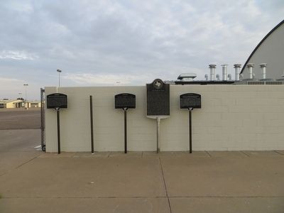
2. The Permian Basin Marker
The Permian Basin Marker is the third marker from the left.
Photographed by Bill Kirchner, July 11, 2015
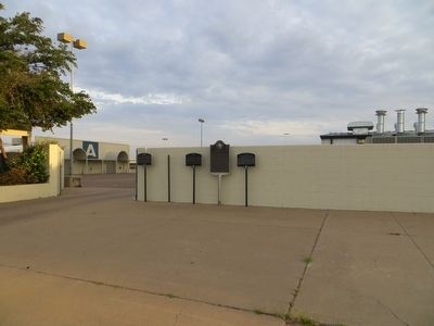
3. The Permian Basin Marker
The Permian Basin Marker is the third marker from the left.
Credits. This page was last revised on June 16, 2016. It was originally submitted on July 27, 2015, by Bill Kirchner of Tucson, Arizona. This page has been viewed 636 times since then and 49 times this year. Photos: 1, 2, 3. submitted on July 27, 2015, by Bill Kirchner of Tucson, Arizona. • Andrew Ruppenstein was the editor who published this page.
