Downtown Seattle in King County, Washington — The American West (Northwest)
Bell Street Bridge
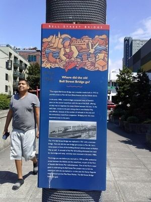
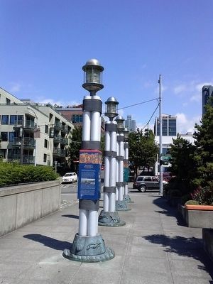
Where did the old Bell Street Bridge go?
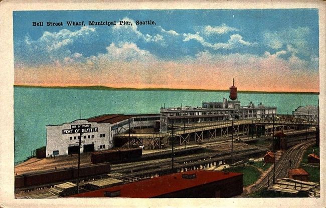
In the early 1900s, trestle bridges connected many of Seattle's piers on the central waterfront with the top of the bluff, offering an easy way to negotiate the steep hillside between the two. In the early days, access to the piers along what is now Alaskan Way was difficult, because of the number of railroads in the area and the tremendous waterfront congestion. Bridging over this mess improved access to the piers.
The 1915 Bell Street Bridge was replaced in 1931 with a concrete bridge. Not only did this new bridge give access to Pier 66, but a ramp system in front of the building allowed vehicle access to Alaskan Way as well. A remodel of the Pier 66 building eliminated the need for the bridge and ramp, and they were removed in the early 1980s.
The bridge you see before you was built in 1995 to offer pedestrian access between the hillside and the waterfront, as part of the Port of Seattle's Bell Street Pier redevelopment. On of the Port's major goals in undertaking the Bell Street Pier project was to link the waterfront with the city behind it - in this case the Denny Regrade neighborhood and the Pike Place Market. The Bell Street Bridge fulfills this goal.
Topics. This historical marker is listed in this topic list: Bridges & Viaducts. A significant historical year for this entry is 1915.
Location. 47° 36.71′ N, 122° 20.904′ W. Marker is in Seattle, Washington, in King County. It is in Downtown Seattle. Marker can be reached from Alaska Way near Elliott Avenue. Touch for map. Marker is in this post office area: Seattle WA 98121, United States of America. Touch for directions.
Other nearby markers. At least 8 other markers are within walking distance of this marker. Seattle-Galway Stone (within shouting distance of this marker); Bell Street Terminal, Pier 66 (within shouting distance of this marker); Why Are the Piers Angled? (about 400 feet away, measured in a direct line); Belltown Pan (about 700 feet away); Austin A. Bell Building (approx. 0.2 miles away); Where did this bridge used to go? / Where does this bridge go now? (approx. 0.2 miles away); Guiry/Schillestad Buildings (approx. 0.2 miles away); “Great White Fleet” (approx. 0.2 miles away). Touch for a list and map of all markers in Seattle.
Photographed By Marsha A. Matson, July 27, 2015
3. Bell Street Bridge Marker II
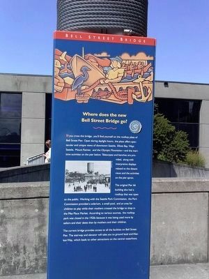
Where does the new Bell Street Bridge go?
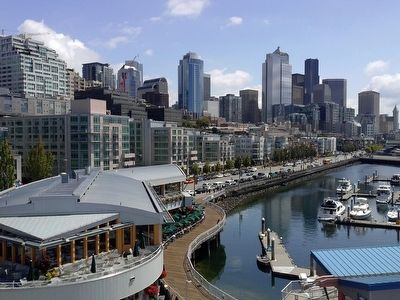
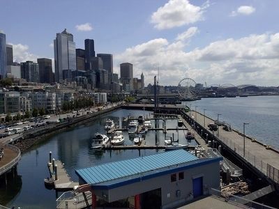
If you cross this bridge, you'll find yourself on the rooftop plaza of the Bell Street Pier. Open during daylight hours, the plaza offers spectacular and unique views of downtown Seattle, Elliott Bay, West Seattle, Mount Rainier, and the Olympic Mountains - and the maritime activities on the pier below. Telescopes and benches are provided, along with interpretive displays related to the distant views and the activities on the pier apron.
The original Pier 66 building also had a rooftop that was open to the public. Working with the Seattle Park Commission, the Port Commission provided a solarium, a small pool, and an area for children to play while their mothers crossed the bridge to shop in the Pike Place Market. According to various sources,the rooftop park was closed in the 1920s because it was being used more by sailors and their dates than by mothers and their children.
The current bridge provides access to all the facilities on Bell Street Pier. The stairway and elevator will take you to ground level and Alaskan Way, which leads to other attractions on the central waterfront.
Credits. This page was last revised on February 7, 2023. It was originally submitted on July 29, 2015, by Marsha A. Matson of Palmetto Bay, Florida. This page has been viewed 452 times since then and 27 times this year. Photos: 1, 2, 3, 4, 5. submitted on July 29, 2015, by Marsha A. Matson of Palmetto Bay, Florida. 6. submitted on July 30, 2015. • Andrew Ruppenstein was the editor who published this page.
