
Near Watsonville in Santa Cruz County, California — The American West (Pacific Coastal)
The Discovery of California Redwoods
Photographed by Barry Swackhamer, July 28, 2015
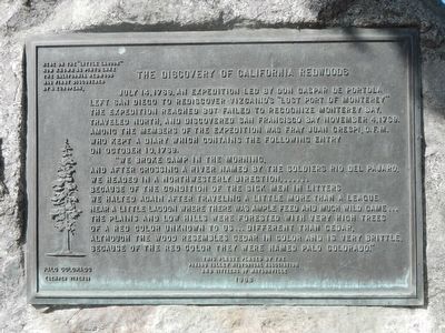
1. The Discovery of California Redwoods Marker
"We broke camp in the morning, and after crossing a river named by the soldiers Rio de Pajaro, we headed in a north wester;y direction... Because of the condition of the sick men in litters we halted again after traveling a little more than a league near a little lagoon where there was ample feed and much wild game... The plains and low hills were forested with very high trees of a red color unknown to us... different than cedar, although the wood resembles cedar in color and is very brittle. Because of the red color they were named palo colorado.
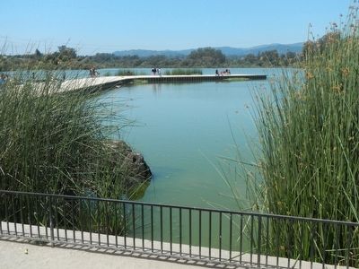
Here on the "little lagoon" now known as Pinto Lake the California Redwood was first discovered by a European.
Erected 1968 by Pajaro Valley Historical Association and Citizens of Watsonville.
this page online
Topics. This historical marker is listed in these topic lists: Exploration • Horticulture & Forestry. A significant historical date for this entry is July 14, 1769.
Location. 36° 56.926′ N, 121° 45.954′ W. Marker is near Watsonville, California, in Santa Cruz County. It is on Pinto Lake Road near Green Valley Road, on the right when traveling west. Touch for map. Marker is at or near this postal address: Pinto Lake Road, Watsonville CA 95076, United States of America. Touch for directions.

Regionally, this marker is on Central Coast and specifically on the Coast Ranges. It is also on the American Pacific Coast. Globally, it is in North America, on the Ring of Fire, in the Pacific Rim, in the Western Hemisphere, in the Western World, and in the Anglosphere. Historically, it finds itself in what was once New Spain and also Mexico’s Alta California.
Other nearby markers. At least 8 other markers are within 3 miles of this marker, measured as the crow flies: Whiskey Hill (approx. 1.1 miles away); James A. Hall (approx. 1.4 miles away); Charley Darkey Parkhurst (approx. 1.6 miles away); Flying A Gas Station (approx. 2.3 miles away);
Photographed by Barry Swackhamer, July 28, 2015
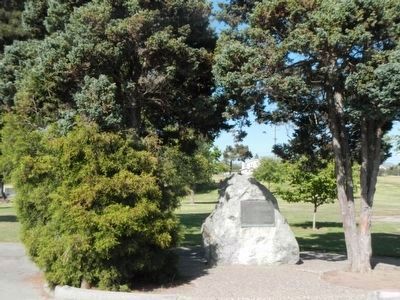
2. The Discovery of California Redwoods Marker
The trees beside this monument are not California Redwoods.
Another marker is no longer nearby. Rancho San Andrés Castro Adobe (was approx. 2½ miles away but has been confirmed missing).
More about this marker. This marker is located at Pinto Lake City Park, not Pinto Lake County Park!
Also see . . . Sequoia sempervirens - Wikipedia. (The) California redwood... is an evergreen, long-lived, monoecious tree living 1,200–1,800 years or more. This species includes the tallest living trees on Earth, reaching up to 379 feet (115.5 m) in height (without the roots) and up to 29.2 feet (8.9 m) in diameter at breast height / dbh. These trees are also among the oldest living things on Earth. (Submitted on July 29, 2015, by Barry Swackhamer of Brentwood, California.)
Photographed by Barry Swackhamer, July 27, 2015
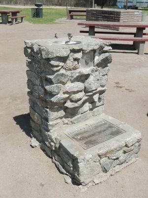
3. Portola Expedition plaque
The plaque on the base of this water fountain, located near the Pinto Lake boat ramp, reads as follows:
Dedicated to
Portola's Expedition
1769
Native Sons of the Golden West
Watsonville Parlor No. 65
Native Daughters of the Golden West
El Pajaro Parlor No. 35
April 29, 1969
Portola's Expedition
1769
Native Sons of the Golden West
Watsonville Parlor No. 65
Native Daughters of the Golden West
El Pajaro Parlor No. 35
April 29, 1969
Photographed by Barry Swackhamer, July 27, 2015
4. Pinto Lake
Credits. This page was last revised on June 16, 2016. It was originally submitted on July 29, 2015, by Barry Swackhamer of Brentwood, California. This page has been viewed 795 times since then and 84 times this year. Photos: 1, 2, 3, 4. submitted on July 29, 2015, by Barry Swackhamer of Brentwood, California. • Andrew Ruppenstein was the editor who published this page.
