Stanton in Martin County, Texas — The American South (West South Central)
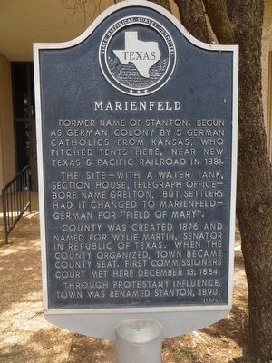
Marienfeld
Photographed by Bill Kirchner, July 11, 2015
1. Marienfeld Marker
The site -- with a water tank, section house, telegraph office - bore name Grelton, but settlers had it changed to Marienfeld, German for "Field of Mary."
County was created 1876 and named for Wylie Martin, senator in Republic of Texas. When the county organized, town became county seat. First commissioners court met here December 13, 1884.
Through Protestant influence, town was renamed Stanton, 1890.
Erected 1970 by State Historical Survey Committee. (Marker Number 3212.)
Topics. This historical marker is listed in this topic list: Settlements & Settlers. A significant historical month for this entry is December 1965.
Location. 32° 7.875′ N, 101° 47.445′ W. Marker is in Stanton, Texas, in Martin County. It is on St Peter Street north of Broadway, on the left when traveling north. Touch for map. Marker is in this post office area: Stanton TX 79782, United States of America. Touch for directions.

Regionally, this marker is in West Texas. It is also in the American Southwest.
this page online
Other nearby markers. At least 8 other markers are within 2 miles of this marker, measured as the crow flies: Old Martin County Jail (within shouting distance of this marker); Stanton Church of Christ (about 500 feet away, measured in a direct line); First United Methodist Church of Stanton (about 800 feet away); Connell House (approx. 0.2 miles away); Site of St. Joseph's Church (approx. 0.2 miles away); Carmelite Monastery (approx. 0.2 miles away); J. E. Millhollon Ranch House (approx. 1.1 miles away); Martin County (approx. 1.3 miles away). Touch for a list and map of all markers in Stanton.
Photographed by Bill Kirchner, July 11, 2015
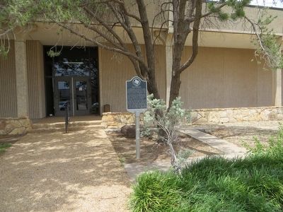
2. Marienfeld Marker
Photographed by Bill Kirchner, July 11, 2015
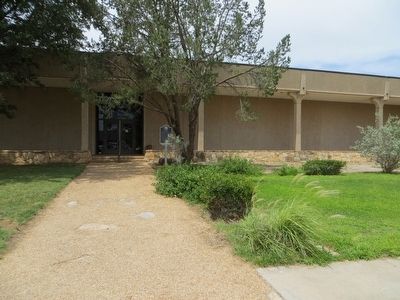
3. Marienfeld Marker
Credits. This page was last revised on June 16, 2016. It was originally submitted on July 31, 2015, by Bill Kirchner of Tucson, Arizona. This page has been viewed 553 times since then and 40 times this year. Photos: 1, 2, 3. submitted on July 31, 2015, by Bill Kirchner of Tucson, Arizona. • Andrew Ruppenstein was the editor who published this page.
