Mobile in Mobile County, Alabama — The American South (East South Central)
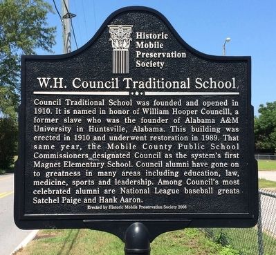
W.H. Council Traditional School
Photographed by Mark Hilton, July 26, 2015
1. W.H. Council Traditional School Marker
Erected 2008 by Historic Mobile Preservation Society.
Topics. This historical marker is listed in these topic lists: African Americans • Education. A significant historical year for this entry is 1910.
Location. 30° 40.304′ N, 88° 3.008′ W. Marker is in Mobile, Alabama, in Mobile County. It is at the intersection of Virginia Street and Wilkinson Street, on the right when traveling west on Virginia Street. Touch for map. Marker is at or near this postal address: 751 Wilkinson Street, Mobile AL 36603, United States of
this page online

Regionally, this marker is on the Gulf Coast and in the Mobile Bay area. It is also in the American South, specifically in the Deep South, and on the Gulf Coast. Globally, it is in North America, a Gulf of Mexico state, the Western Hemisphere, the Western World, and the Anglosphere. Historically, it finds itself in what was once New Spain, the Viceroyalty of New France, the territory of the Mississippian Culture, one of the Confederate States of America, and the Antebellum South.
Other nearby markers. At least 8 other markers are within walking distance of this marker: St. Martin de Porres Hospital (about 700 feet away, measured in a direct line); Restoring Justice / Lives Lost in The Segregation Era (approx. 0.4 miles away); Confederate Rest (approx. 0.6 miles away); Sha'arei Shomayim Cemetery (approx. 0.7 miles away); Home of Joe Cain (approx. 0.7 miles away); Emerson Institute (approx. 0.8 miles away); Jewish Rest Magnolia Cemetery (approx. 0.8 miles away); Battle of Fort Blakely Monument (approx. 0.8 miles away). Touch for a list and map of all markers in Mobile.
Related markers.
Photographed by Mark Hilton, July 26, 2015
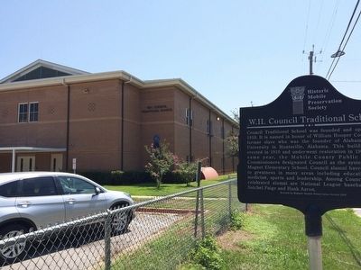
2. W.H. Council Traditional School
Also see . . . Wikipedia article on Councill. (Submitted on August 1, 2015, by Mark Hilton of Montgomery, Alabama.)
Photographed by Mark Hilton, July 26, 2015
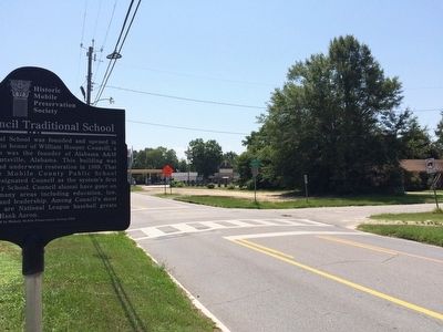
3. View of marker looking east on Virginia Street.
Public Domain, 1902
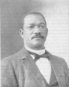
4. William Hooper Councill
Credits. This page was last revised on August 30, 2020. It was originally submitted on August 1, 2015, by Mark Hilton of Montgomery, Alabama. This page has been viewed 1,593 times since then and 182 times this year. Photos: 1, 2, 3, 4. submitted on August 1, 2015, by Mark Hilton of Montgomery, Alabama.
