Brusly in West Baton Rouge Parish, Louisiana — The American South (West South Central)
Brusly, Louisiana
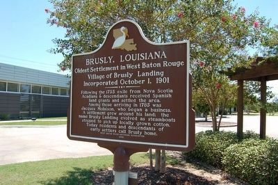
Oldest Settlement In West Baton Rouge
— Village Of Brusly Landing Incorporated October 1, 1901 —
Side A
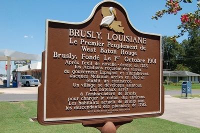
Side B
Le Premier Peuplement de West Baton Rouge
Brusly, Fondé Le 1er Octobre 1901
Après l'exil de nouvelle-écosse en 1755, les Acadiens recurent des terres du gouverneur Espagnol et s'installèrent. Jacques Molaison arriva en 1785 et établit un commerce. Un village se développa alentour. Les bateaux arrêt à l'embarcadère de Brusly pour charger le coton des environs. Les habitants actuels de Brusly sont les descendants des pionniers de 1785.
Erected 2003 by West Baton Rouge Historical Association.
Topics. This historical marker is listed in this topic list: Settlements & Settlers. A significant historical year for this entry is 1755.
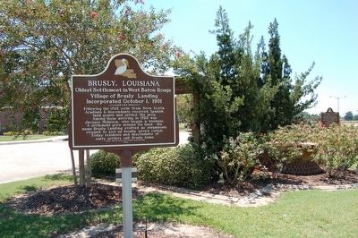
Location. 30° 23.172′ N, 91° 14.672′ W. Marker is in Brusly, Louisiana, in West Baton Rouge Parish. Marker is at the intersection of South Vaughn Drive (State Highway 1) and East St. Francis Street, on the left when traveling south on South Vaughn Drive. Located in the Town of Brusly Memorial Plaza. Touch for map. Marker is at or near this postal address: 610 S Vaughn Drive, Brusly LA 70719, United States of America. Touch for directions.
Other nearby markers. At least 8 other markers are within walking distance of this marker. Open Sugar Kettles (here, next to this marker); Charles P. Adams (a few steps from this marker); New Brusly Town Hall Memorial (a few steps from this marker); Herbert Osborn Dickerson (within shouting distance of this marker); Historic Lukeville School (approx. 0.3 miles away); Antioch Missionary Baptist Church (approx. 0.4 miles away); St. John the Baptist Catholic Cemetery (approx. 0.4 miles away); Union Baptist Church (approx. half a mile away). Touch for a list and map of all markers in Brusly.
Credits. This page was last revised on August 24, 2023. It was originally submitted on August 2, 2015. This page has been viewed 484 times since then and 24 times this year. Photos: 1, 2, 3. submitted on August 2, 2015. • Bernard Fisher was the editor who published this page.


