Antioch Acres in Kansas City in Clay County, Missouri — The American Midwest (Upper Plains)
Antioch Church
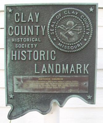
Clay County Historic Landmark
Photographed by William Fischer, Jr., July 29, 2015
1. Antioch Church Marker
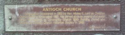
Congregation established in 1853 by Rev. Moses E. Lard as Christian Church. Building constructed 1859. Has served since as worship and social center. Reorganized as Community Church 1930. Building moved and [illegible] by Antioch Church Historical Society in 1968.
Erected 1976 by Clay County Historical Society.
Topics and series. This historical marker is listed in these topic lists: Religion & Religious Structures • Settlements & Settlers. In addition, it is included in the Missouri, Clay County Historic Landmarks series list. A significant historical year for this entry is 1853.
Location. 39° 10.865′ N, 94° 32.913′ W. Marker is in Kansas City, Missouri, in Clay County. It is in Antioch Acres. It is at the intersection of NE Antioch Road (Missouri Route 1) and NE 48th Street, on the right when traveling north on NE Antioch Road. Touch for map. Marker is at or near this postal address: 4805 NE Antioch Road, Kansas City MO 64119, United States of America. Touch for directions.

Regionally, this marker is in the Missouri River Corridor. It is also in the American Midwest, in the Lewis & Clark Corridor, and in
this page online
Other nearby markers. At least 8 other markers are within 3 miles of this marker, measured as the crow flies: A different marker also named Antioch Church (here, next to this marker); a different marker also named Antioch Church (a few steps from this marker); Old Pike Road / Ferry Boat Operators at Kawsmouth (approx. 2 miles away); Atkins-Johnson House (approx. 2.4 miles away); Atkins-Johnson Farmhouse (approx. 2.4 miles away); Atkins-Johnson Farm (approx. 2.4 miles away); Replica of the Statue of Liberty (approx. 2.8 miles away); War Memorial (approx. 2.8 miles away). Touch for a list and map of all markers in Kansas City.
Photographed by William Fischer, Jr., July 29, 2015
2. Antioch Church Marker
Photographed by William Fischer, Jr.
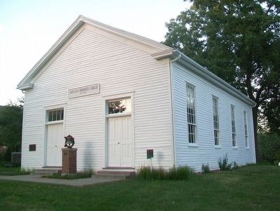
3. Antioch Church, c.1859
Chruch website homepage:
Click for more information.
Click for more information.
Credits. This page was last revised on February 10, 2023. It was originally submitted on August 2, 2015, by William Fischer, Jr. of Reynoldsburg, Ohio. This page has been viewed 864 times since then and 60 times this year. Photos: 1, 2, 3. submitted on August 2, 2015, by William Fischer, Jr. of Reynoldsburg, Ohio.
