Bonnybridge in Falkirk, Scotland, United Kingdom — Northwestern Europe (the British Isles)
The Antonine Wall
At Rough Castle
— #1 —
THE LANDSCAPE
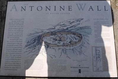
Around 10,000 years ago the landscape would have been fairly thickly covered with trees. Into this environment came our hunting and gathering ancestors around 8,000 years ago. These people would have cleared some of the trees for hunting.
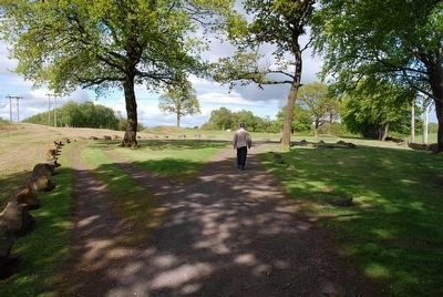
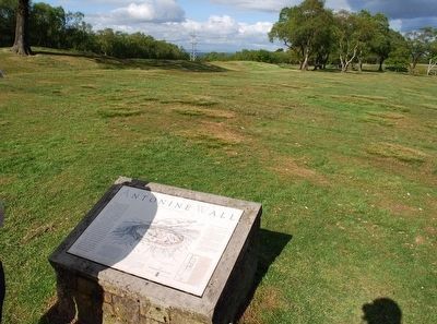
Around 6,000 years ago people in Scotland started to grow crops and domesticate animals. This resulted in some further clearance, although much of the landscape would have remained covered in trees. The type of semi-natural birch woodland would probably have been much as you can see in front of you, with some of the landscape cleared for farming but large areas of woodland remaining.
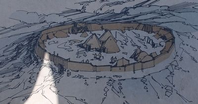
About 2,000 years ago, the local people had a settled life, living in circular houses in farmsteads or small settlements, sometimes protected by an earthwork enclosure or wooden fence. One of these settlements is illustrated on this board.
In the second century AD the Romans conquered this area and built the Antonine Wall, one of the most massive and important surviving frontier works of the Roman Empire. At that time they would have cleared all the trees and the local population from the immediate area.
From the Roman times to the present day this area has been continually farmed, although since the eighteenth century coal mining has developed as a major industry. From where you are standing you can see the massive spoil heaps from present-day opencast mining.
The intensity of land use has declined during the last twenty years leading to the growth of birch trees and thick vegetation around the Roman remains. Historic Scotland protects the fragile remains by keeping the archaeological features free from bushes and thick undergrowth.
NATURE CONSERVATION
In addition to the birch woodland the archaeological site at Rough Castle has its own natural history interest, which Historic Scotland endeavours to safeguard.
The site comprises an extensive area of former dry heathland, much of which has been converted to dry acid grassland by regular mowing.
The heath is best represented on the archaeological earthworks of the upcast mound and rampart of the Antonine Wall and the remains of the fort and annex.
This area is one of the few surviving areas of dry heathland in the locality and forms part of a diverse mosaic of habitats with the adjacent birch woodland and the wet heath to the north and east of the site.
Historic Scotland is now leaving the grass to grow longer. This should encourage the heathland to return across the site without detracting from your appreciation of the monument.
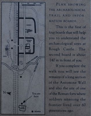
PLAN SHOWING THE ARCHAEOLOGICAL TRAIL AND INFORMATION BOARDS.
This is the first of four boards that will help you to understand the archaeological sites at Rough Castle. The second board is about 140m in front of you.
If you complete the walk you will see the remains of a long section of the Antonine Wall and also the site of one of the Roman forts where soldiers manning the frontier lived over 60 generations ago.
(Illustration text)
A native settlement as it might have looked 2,000 years ago.
Topics. This historical marker is listed in these topic lists: Forts and Castles • Horticulture & Forestry • Settlements & Settlers.
Location. 55° 59.838′ N, 3° 51.621′ W. Marker is in Bonnybridge, Scotland, in Falkirk. Marker can be reached from Bonnyside Road. Touch for map. Marker is in this post office area: Bonnybridge, Scotland FK4 2AA, United Kingdom. Touch for directions.
Other nearby markers. At least 8 other markers are within 5 kilometers of this marker, measured as the crow flies. A different marker also named The Antonine Wall (about 120 meters away, measured in a direct line); The Northern Defences (approx. 0.3 kilometers away); The Roman Fort (approx. 0.3 kilometers away); a different marker also named Antonine Wall (approx. half a kilometer away); Antonine Wall Rough Castle (approx. half a kilometer away); Forth & Clyde Ship Canal (approx. 1.2 kilometers away); Battle of Falkirk Muir (approx. 2.9 kilometers away); The Parish Church Graveyard (approx. 4.6 kilometers away).
Related markers. Click here for a list of markers that are related to this marker. To better understand the relationship, study each marker listed here.
Credits. This page was last revised on January 27, 2022. It was originally submitted on August 5, 2015, by Brandon Fletcher of Chattanooga, Tennessee. This page has been viewed 299 times since then and 5 times this year. Photos: 1, 2, 3, 4, 5. submitted on August 5, 2015, by Brandon Fletcher of Chattanooga, Tennessee. • Andrew Ruppenstein was the editor who published this page.
